
England
& Wales Hardwicke Marriage Index
Marriages
1754 - 1837
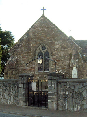
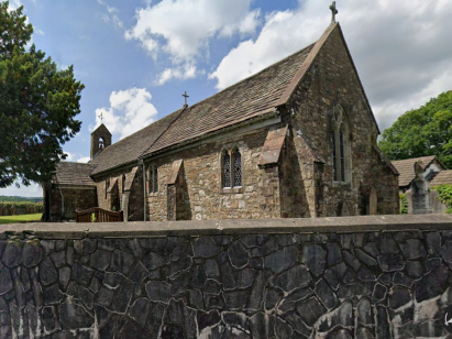
Bettws St David
| |
England
& Wales Hardwicke Marriage Index |
The ParishThe parish of Bettws, spelt Betws on modern Ordnance Survey mapping) lies in the extreme southeast of Carmarthenshire forming a lengthy stretch of the border with neighbouring Glamorgan. Bettws is located roughly 8 miles south of the market town of Llandeilo and sits a half mile east of the A483 which links Llandeilo with Pontardulais. Whilst Bettws grants its name to the parish it is bar far the smallest settlement, but oldest, as the Victorian creation of Ammanford forms the major settlement within the parish. Bettws sits east of Afon Aman and is a triangular settlement, a main street leading up the hill and another paralleling the river. Ammanford did not exist as a coherent settlement at the time of this transcript, it was mining of, in particular anthracite, that saw it grow into a sizeable town, previously it was know merely as Cross Inn, a reference to its position as a crossroad with prominent inn. Prior to the growth of industry the main economic driver of the parish was pastoral farming, cattle in the valley bottoms and sheep on the extensive hilly interior of Mynydd y Bettws to the southeast. Late Victorian industrial growth came not only from anthracite extraction but also a tin-plate & chemical works. Today Bettws is the satellite settlement and Ammanford has almost grown to be a market town. Modern developments have come to the parish, the railway line between Llandeilo and Swansea passing through with Ammanford granted a station. The parish is drained by Afon Aman & Afon Llwchyr, the two merging just to the south of Ammanford, the Llwchyr continues the short distance to the outer Bristol Channel arriving past the village of Loughor. Bettws is sited on steeply rising ground from 40 to 130 metres above the sea whilst Ammanford largely sits on level ground at the river's confluence at close to 40 metres, land rises steeply onto extensive mountainous land of Mynydd y Bettws which summits at 341 metres in an extensive upland block forming the border with Glamorgan. Like most upland parishes that of Bettws was rather extensive, covering just under 6,500 acres it would have supported a population of close to 1,100 parishioners. Like most of Wales Bettws is not recorded in Domesday Book which did not cover this area. |
 |
|
|
|
| Register No | Covering Dates | Deposited With | Register Style | Quality Standard | Comments |
| 1 |
2nd March 1756 - 11th December 1812 |
Carmarthenshire Archive Service - Reference - CPR/54/6 |
Standard preprinted and self-numbered combined Banns &
Marriage register with 4 entries per page |
Grade 2 Register - not a perfect read but with a low
likelihood of misreads |
None |
| 2 | 15th January 1813 - 3rd June 1837 | Carmarthenshire Archive Service - Reference - CPR/54/7 | Standard Rose style preprinted and prenumbered Marriage register | Grade 2 Register - not a perfect read but with a low likelihood of
misreads |
None |
|
Llandybie
St Tybie
|
Llandybie
St Tybie
Llandilo Fawr St Teilo |
Llangiwg
St Ciwg, Glamorgan
|
|
Llandybie
St Tybie
|
 |
Llangiwg
St Ciwg, Glamorgan
|
|
Llangyfelach
St Cyfelach, Glamorgan
|
Llangyfelach
St Cyfelach, Glamorgan
|
Llangyfelach
St Cyfelach, Glamorgan
|
1760 1770 1780 1790 1800 1810 1820 1830
Corrections to Tinstaafl Transcripts