
England
& Wales Hardwicke Marriage Index
Marriages
1754 - 1837
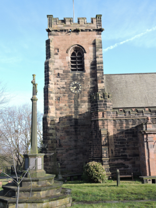
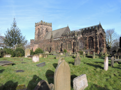
Frodsham St Laurence
| |
England
& Wales Hardwicke Marriage Index |
The ParishThe parish of Frodsham lies in the extreme north of Cheshire forming a stretch of the county's border with neighbouring Lancashire, the border being formed by the broad estuary of the River Mersey. Frodsham is located roughly 10 miles northeast of the county town of Chester and stands on the A56 road which links Chester with Warrington. Frodsham is a market town and regional centre for shopping and trade, the early town consisted merely of a single long street (the route of the A56) with the subsidiary settlement of Overton, containing the parish church, sitting above on a bluff of sandstone, the final termination of a lengthy ridge forming a spine across the county. Frodsham is separated from the expanding new town of Runcorn by the course of the River Weaver. Several townships including Alvanley, Helsby, Kingsley, Manley, Newton-by-Frodsham, and Norley also lie within the extensive parish, today Helsby is a substantial village a mile southwest and sitting below its own sandstone bluff and Kingsley some 3 miles southeast is a village large enough to merit its own parish in more southern areas of the land. At the time of this transcript Frodsham parish was almost entirely agricultural, inland arable whilst the extensive salt flats to the north offered rich pastures. Frodsham, itself, has expanded considerably in modern times spreading along the A56 for almost 2 miles of continuous urban development but constrained to the north by the modern M56 and to the east by the Weaver. Modern developments abound in the area, the Weaver Navigation is part of the extensive Cheshire canal network whilst to the north of the marshes lies the mighty Manchester Ship Canal built to bring cotton to Manchester and avoid the former double-handling at Liverpool. Railways arrived in 1850 with a line from Chester to Warrington serving Frodsham with a station and spurring some commuter growth as mansions were built for the wealthy high above the town. The final infrastructure arrived as the M56 motorway connecting Chester and North Wales to the M6 spine. The Weaver drains the parish the short distance to the Mersey Estuary which then takes water to the Irish Sea. Frodsham is sited at around 15 metres above the sea at the A56 but rises to over 150 metres atop the sandstone ridge to the south. Frodsham parish was extensive, early gazetteers estimate it to be over 32 miles in circumference and about 15,000 acres in extent, that acreage supporting close to 5,800 parishioners. Domesday Frodsham was altogether a much smaller place, a holding of Earl Hugh of Chester its assets of 4 ploughs backed by meadows & woodland were, however strongly enhanced by its mill, 2 fisheries with a further half share and a half share in a salthouse giving a substantial income to the Earl. In addition to Frodsham's holding Earl Hugh also held Kingsley with a further plough and 2 more fisheries as well as Helsby and Alvanley which added a further plough each. |
 |
|
|
|
| Register No | Covering Dates | Deposited With | Register Style | Quality Standard | Comments |
| 1 |
25th April 1754 - 4th June 1781 |
Cheshire Archives & Local Studies - Reference -
P8/2619/3/1 |
Standard preprinted and self-numbered combined Banns &
Marriage register with 4 entries per page |
Grade 2 Register - not a perfect read but with a low
likelihood of misreads |
None |
| 2 | 25th June 1781 - 18th September 1792 | Cheshire Archives & Local Studies - Reference - P8/2619/3/2 | Standard preprinted and self-numbered Marriage register with 4 entries per page | Grade 2 Register - not a perfect read but with a low likelihood of
misreads |
None NB the clerk creates some confusion by adding marital status in the signature boxes |
| 3 | 4th November 1792 - 21st July 1801 | Cheshire Archives & Local Studies - Reference - P8/2619/1/3 | Plain, unruled book, a composite register in contravention of Hardwicke's segregation & wording requirements | Grade 3 Register - there are sufficient quality issues with this
register to indicate that some misreads will occur albeit few in
number |
A few entries towards the end of this register are faded and may
result in one or two misreads NB the entries are entered in reverse order through the register. |
| 4 | 26th July 1801 - 29th December 1812 | Cheshire Archives & Local Studies - Reference - P8/2619/3/3 | Standard preprinted and self-numbered Marriage register with 3 entries per page | Grade 2 Register - not a perfect read but with a low likelihood of
misreads |
None |
| 5 | 7th January 1813 - 25th June 1837 | Cheshire Archives & Local Studies - Reference - P8/2619/3/4 | Standard Rose style preprinted and prenumbered Marriage register | Grade 2 Register - not a perfect read but with a low likelihood of
misreads |
None |
|
|
|
Runcorn
All Saints
|
 |
||
|
Barrow
St Bartholomew
|
Tarvin
St Andrew
Delamere St Peter |
Weaverham
St Mary
|
Corrections to Tinstaafl Transcripts