
England
& Wales Hardwicke Marriage Index
Marriages
1754 - 1837
Latchford St James
| |
England
& Wales Hardwicke Marriage Index |
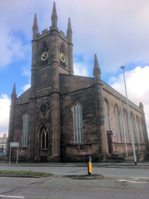
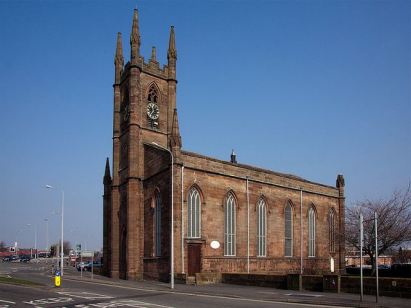
The ParishThe parish of Latchford, created in 1777 from its mother parish of Grappenhall, is located in the extreme north of Cheshire forming a stretch of the county's border with neighbouring Lancashire. Latchford sits about 1 mile southeast of the Lancashire industrial town of Warrington, separated only by the River Mersey which here forms the boundary between the two counties, and sitting on the A5061 road lining the A50 to the centre of Warrington. Latchford today is merely a suburb of Warrington which straddles the two counties, a place of closely set housing, small shops & businesses and a little light industry. Latchford is drained westwards by the Mersey headed through the twin ports of Liverpool & Birkenhead into the Irish Sea. Latchford is sited at around sea level, the church of St James standing at a metre above that level, land rises gently away from the river reaching 80 metres within 2-3 miles. Around 1,000 acres of Grappenhall parish was assigned to Latchford within which a substantial population of almost 2,400 parishioners resided, most marriages and all marriages before 1833 took place at Grappenhall. Latchford is not mentioned in Domesday Book. |
 |
|
|
|
| Register No | Covering Dates | Deposited With | Register Style | Quality Standard | Comments |
| 1 |
17th September 1833 - 26th June 1836 |
Cheshire Archives & Local Studies - Reference -
P147/3/1 |
Standard Rose style preprinted and prenumbered Marriage
register |
Grade 2 Register - not a perfect read but with a low
likelihood of misreads |
None |
|
Warrington
St Elphin, Lancashire
|
Warrington
St Elphin, Lancashire
|
Warrington
St Elphin, Lancashire
|
 |
Lymm St
Mary
|
|
Corrections to Tinstaafl Transcripts