England
& Wales Hardwicke Marriage Index
Marriages
1754 - 1837
Old Brampton St Peter & St Paul
 |
England
& Wales Hardwicke Marriage Index |
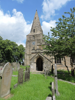
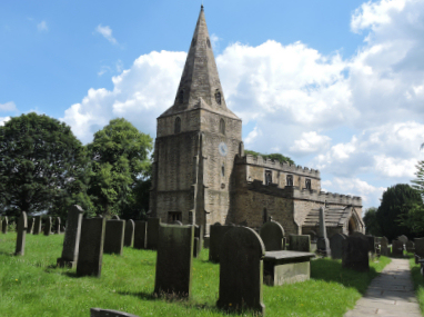
The ParishThe parish of Old Brampton (given its prefix to distinguish it from the suburb of Chesterfield) lies in northern Derbyshire about 3 miles west of Chesterfield. Old Brampton sits about a mile north of the A619 road which connects Chesterfield with Bakewell and the Peak District National Park. The village of Old Brampton is a straggle of properties lining a lane (Main Road) which parallels the A619. Whilst today's Old Brampton is a modestly sized village the wider parish was a hive of industry. The geological assets of coal, ironstone and good quality clay lead to widespread employment not only in the extractive industries but also in manufacture of clay pipes, earthenware and an iron foundry. The steep slopes descending from the Peak District lead to some local spinning and bobbin manufacture for that industry too. Besides these industrial employs farming was important too, largely pastoral with cattle on lower ground and sheep to the uplands further west. Today Old Brampton sits just beyond the growing fringe of Chesterfield's suburbs and appears a tranquil rural place with some tourism due to its proximity to the National Park. Old Brampton is drained eastwards by a combination of the Holme Brook and the River Nipper, both join the Rother in Chesterfield which heads determinedly north to meet the Don one of many rivers converging on the Humber Estuary to reach the North Sea. This is quite an upland area with the village sited at between 160 and 200 metres above the sea, land rises westwards into the Peak District with heights of over 300 metres before the Derbyshire Edge's are reached, a haunt of rock climbers overlooking Chatsworth Estate. Upland parishes are often extensive and Old Brampton was no exception, covering almost 8,000 acres, of which early gazetteers describe almost 1,100 acres as "waste" the wider parish would have supported a population of just over 3,900 parishioners. In Domesday times Old Brampton was a modest place, shared between one Walter d'Aincourt & Hascoit Musard its assets totalled just 8 ploughs as well as extensive woodland and meadows. |
 |
|
|

|
| Register No | Covering Dates | Deposited With | Register Style | Quality Standard | Comments |
| 1 |
8th February 1756 - 4th December 1812 |
Derbyshire Record Office - Reference - D947/A/PI/3/1 |
Standard preprinted and self-numbered combined Banns &
Marriage register with 4 entries per page |
Grade 2 Register - not a perfect read but with a low
likelihood of misreads |
None |
| 2 | 7th March 1813 - 15th May 1837 | Derbyshire Record Office - Reference - D947/A/PI/3/2 | Standard Rose style preprinted and prenumbered Marriage register | Grade 2 Register - not a perfect read but with a low likelihood of misreads | None |
|
Baslow
St Anne
|
Barlow
St Lawrence
|
Chesterfield
St Mary & All Saints
|
|
Baslow
St Anne
|
 |
Chesterfield
St Mary & All Saints
Brampton St Thomas |
|
Chesterfield
St Mary & All Saints
|
Chesterfield
St Mary & All Saints
|
1760 1770 1780 1790 1800 1810 1820 1830
Corrections to Tinstaafl Transcripts