
England
& Wales Hardwicke Marriage Index
Marriages
1754 - 1837
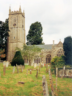
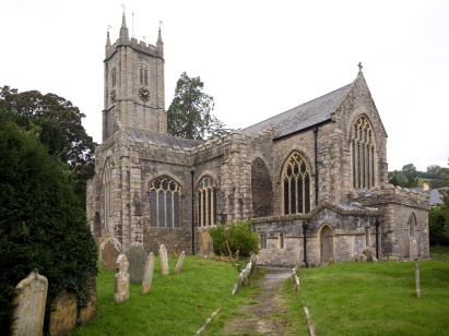
Ashburton St Andrew
| |
England
& Wales Hardwicke Marriage Index |
The ParishThe parish of Ashburton lies in southern Devon roughly 19 miles southwest of Exeter and 24 northeast of Plymouth. Ashburton is a mid-sized market town which formerly lay on the A38 road which links Exeter & Plymouth and sits on the southeastern edge of Dartmoor. Ashburton is a rather linear town, the majority of properties lie either side of the former A38, now B3352, which runs from northeast to southwest, there have been modern developments to both the north of the northern part and infill between the old & new routes of the A38 but essentially the town is a ribbon of urban properties stretching for almost 2 miles. Ashburton has a long history, it was made a borough in 1238 and achieved its market in 1310, its prosperity coming from two distinct sources; the wide parish has extensive herds of cattle, a source of trade along with other agricultural produce, but it is from the extractive industries that Ashburton really earned its income. In the later Middle Ages Ashburton was one of only 4 Devon towns allowed to trade in tin whilst copper was also extracted and traded. Supplementing these sources the town became noted for the production of cloth, especially serge for which it had a lucrative contract with the East India Company. Modern developments have come to the town with the raising of the A38 almost to motorway standard, a welcome relief from the congestion the town streets once suffered. Today Ashburton is an important tourist centre for exploring Dartmoor, a base for many to stay. Ashburton is drained southwestwards by the River Ashburton which meets the Dart at nearby Buckfastleigh before heading into the English Channel by the latter's broad sea channel. Ashburton sits in a steeply sided valley at around 70 metres above the sea, some of the modern developments to its northern edge rise as high as 100 metres whilst the strongly undulating countryside rises to 313 metres at nearby Ausewell Rocks to the town's west, a forerunner of much higher ground onto Dartmoor proper. Ashburton parish was one of the most extensive in its county, covering almost 5,100 acres it is reminiscent of northern upland parish in extent, of that acreage almost 10% is, however, described as "waste" in early gazetteers; Ashburton parish would have supported around 3,800 parishioners. In Domesday times Ashburton was a holding of the Bishop of Exeter offering 18 ploughs, some meadows & pastures and extensive woodland of a league, forests are still a feature of the local landscape, its population was sufficient to place it amongst the largest 20% of settlements recorded in that book. |
 |
|
|
|
| Register No | Covering Dates | Deposited With | Register Style | Quality Standard | Comments |
| 1 |
3rd April 1754 - 6th February 1768 |
Devon Heritage Centre - Reference - 2141A/PR/1/10 |
Standard preprinted and self-numbered Marriage register
with 3 entries per page |
Grade 1 Register - Few issues noted and a low likelihood
of misreads |
None |
| 2 | 7th February 1768- 4th August 1805 | Devon Heritage Centre - Reference - 2141A/PR/1/11 | Standard preprinted and self-numbered Marriage register with 4 entries per page | Grade 1 Register - Few issues noted and a low likelihood of
misreads |
None |
| 3 | 2nd September 1805 - 30th December 1812 | Devon Heritage Centre - Reference - 2141A/PR/1/12 | Standard preprinted and self-numbered Marriage register with 3 entries per page | Grade 1 Register - Few issues noted and a low likelihood of
misreads |
None |
| 4 | 4th January 1813 - 26th June 1837 | Devon Heritage Centre - Reference - 2141A/PR/1/13 | Standard Rose style preprinted and prenumbered Marriage register | Grade 2 Register - not a perfect read but with a low likelihood of
misreads |
None |
|
Widecombe
in the Moor St Pancras
|
Ilsington
St Michael
|
|
 |
||
|
Buckfastleigh
Holy Trinity
|
Staverton
St Paul de Leon
|
Woodland
St John
|
1760 1770 1780 1790 1800 1810 1820 1830
Corrections to Tinstaafl Transcripts