
England
& Wales Hardwicke Marriage Index
Marriages
1754 - 1837
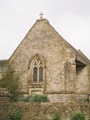
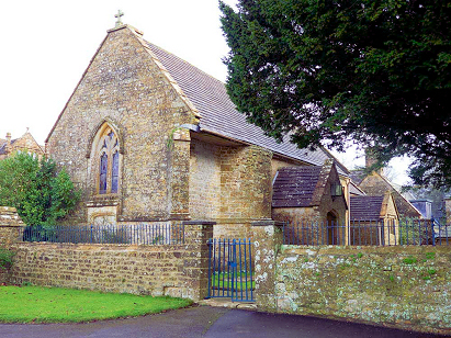
Mapperton All Saints
| |
England
& Wales Hardwicke Marriage Index |
The ParishThe parish of Mapperton lies in southwestern Dorset about 2 miles southeast of the market town of Beaminster. Mapperton sits about a mile south of the B3163 road, a linking road that connects Beaminster with the A359 (Dorchester to Crewkerne) road. Mapperton is an estate village, actually little more than a hamlet which is dominated by the manor house and its grounds, the parish functioned as a "closed parish" with almost all land held by a single landowner who restricted access and as a consequence no formal village developed. The sole access is by narrow lane south of the B3163 off which an even narrower lane leads to what Pevsner calls "an enchanting manorial group", nowadays quite a tourist attraction in its own right as a survivor. Mapperton sits in chalk country, at the time of this transcript sheep would have provided the main income but the land has migrated increasingly towards arable farming over time. Sitting on porous chalk Mapperton is mainly drained sub-surface, a tributary of the River Brit eventually arising and leading westwards to join that river, the Brit meets the nearby English Channel through Bridport. Mapperton sits at around 120 metres above the sea in an enclosed amphitheatre with chalk downs looming all around and rising to almost 220 metres on Dimstone Hill to the northeast. Mapperton was also a small parish in terms of its acreage covering only a little over 800 acres it would only have supported a population of between 50 & 100 parishioners. In Domesday times Mapperton was altogether a more important place, shared between Arnulf de Hesdin and William de Mohun its assets totalled 7 ploughs, meadows, pasture & woodland and also had a mill and with 22 households was probably bigger than today. |
 |
|
|
|
| Register No | Covering Dates | Deposited With | Register Style | Quality Standard | Comments |
| 1 |
26th January 1755 - 25th February 1802 |
Dorset History Centre - Reference - PE-MAP/RE/1/1 |
Plain, ruled book, a continuation of the extant composite
register in contravention of Hardwicke's segregation & wording
requirements |
Grade 2 Register - not a perfect read but with a low
likelihood of misreads |
None |
| 2 | 7th December 1814 - 23rd February 1837 | Dorset History Centre - Reference - PE-MAP/RE/3/1 | Standard Rose style preprinted and prenumbered Marriage register | Grade 2 Register - not a perfect read but with a low likelihood of misreads | None |
|
Beaminster
St Mary
|
Hooke
St Giles
|
|
|
Beaminster
St Mary
Netherbury St Mary
|
 |
Hooke
St Giles
|
|
Netherbury
St Mary
|
North
Poorton St Mary Magdalene
|
North
Poorton St Mary Magdalene
|
Corrections to Tinstaafl Transcripts