
England
& Wales Hardwicke Marriage Index
Marriages
1754 - 1837
Llanwonno St Gwynno
| |
England
& Wales Hardwicke Marriage Index |
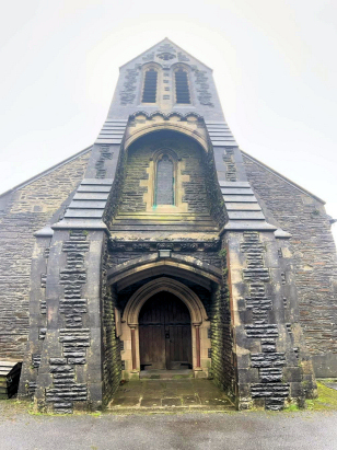
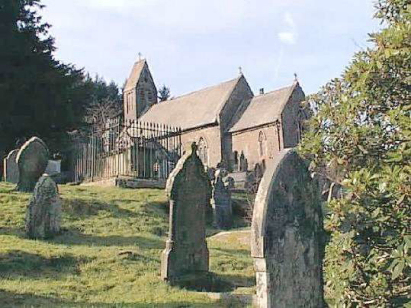
The ParishThe parish of lies in northern Glamorgan comprising much of the famous "valleys" of the county, it lies some 12 miles northwest of the capital, Cardiff. Llanwonno, itself, is a mere spot on the map sitting astride the mountain between Cwm Rhondda and Cwm Clydach. In all the extensive parish covers parts of 3 valleys the Cwm Cynon completing the set. Unusually the parish church sits isolated on its mountain top accompanied only by an inn. Several major roads serve each valley, the A4233 that of the Afon Rhondda Fach, the B4273 that of the Afon Clydach and the A4059 that of the Afon Cynon all headed along the respective valley bottoms and headed towards Cardiff. This is a parish that has changed beyond recognition, at one time a rural scene of pastoral farming echoed in "How Green was my Valley"; the explosion of mining and related heavy industry filling each of the valleys with mines, furnaces and their iconic rows of terraced miners' cottages. Population exploded during the Victorian era with many arriving from other parts of Wales, England and Ireland to take up the positions available in back-breaking work. Modern developments arrived in abundance to speed the flow of goods and raw materials out of the valleys and to the ports, the Aberdare Canal arriving first only to be superceded by both mineral and passenger railways along each valley and all directed to Cardiff and its fast developing port. Today the Rhondda Fach has lost its railway but that up Cwm Cynon remains. All 3 rivers drain southwards to eventually meet at Pontypridd as the Afon Taff which continues southwards to reach the outer Bristol Channel through Cardiff. The parish encompasses ground of may differing heights, the valley bottoms rise steadily from Pontypridd at 50 metres with their upper reaches such as Mountain Ash at 120 metres and Maerdy at 280, the church of St Gwynno stands at 340 metres but is far from being the highest ground within the parish that honour falls to Mynydd Maerdy above Treorchy at 482 metres. Llanwonno parish covered a substantial proportion of northern Glamorgan totalling just over 13,000 acres which would have supported a population reaching over 1,600 by the end of the transcript period but probably averaging around 1,000 during it. Like most of Wales Llanwonno is not mentioned in Domesday Book which did not cover this area. |
 |
|
|
|
| Register No | Covering Dates | Deposited With | Register Style | Quality Standard | Comments |
| 1 | 18th May 1754 - 13th November 1813 | Glamorgan Archives, Cardiff - Reference - NLW/LLANWYNNO/REGISTER/2 | Plain, ruled book containing combined Banns & Marriages | Grade 3 Register - there are sufficient quality issues with this register to indicate that some misreads will occur albeit few in number | Poor handwriting may lead to one or two misreads |
| 2 | 1st February 1814 - 20th May 1837 | Glamorgan Archives, Cardiff - Reference -
NLW/LLANWYNNO/REGISTER/5 |
Standard Rose style preprinted and prenumbered Marriage register | Grade 2 Register - not a perfect read but with a low
likelihood of misreads |
None |
|
Aberdare
St John
|
Aberdare
St John
|
Merthyr
Tydfil St Tydfil
|
|
Ystradyfodwg
St John
|
 |
|
|
Llantrisant
St Illtyd, St Wonno & St Dyfodwg
|
Llantrisant
St Illtyd, St Wonno & St Dyfodwg
Llantwit Fardre St Illtyd |
Eglywsilan
St Ilan
|
1760 1770 1780 1790 1800 1810 1820 1830
Corrections to Tinstaafl Transcripts