
England
& Wales Hardwicke Marriage Index
Marriages
1754 - 1837
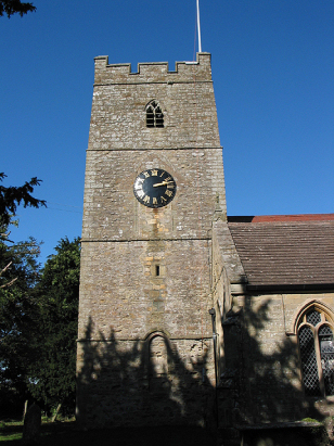
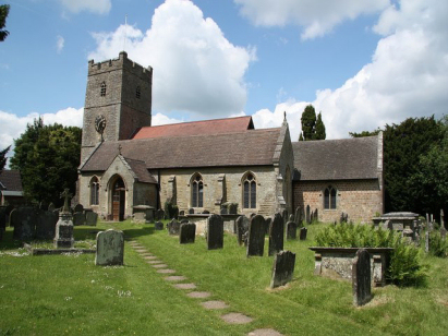
English Bicknor St Mary
| |
England
& Wales Hardwicke Marriage Index |
The ParishThe parish of English Bicknor lies in the extreme northwest of Gloucestershire forming a stretch of the border with neighbouring Herefordshire and also a small, but not insignificant stretch of the border with Monmouthshire & hence also Wales. English Bicknor is located roughly 6 miles northeast of the market town of Monmouth, a journey that becomes 10 miles by road and sits a little over 2 miles northwest of the A4136 road which links Monmouth with Mitcheldean. English Bicknor is a long straggle of a village with most properties lying along a lane which runs from north to south, around the church there's a notable concentration, however. It is the River Wye which forms the dominant landscape feature hereabouts, its deeply incised meandering course passing around English Bicknor both to its north and west wherein lies the beautiful viewpoint of Symonds Yat Rocks. English Bicknor lies within the former Royal Hunting Forest of the Forest of Dean and the area abounds with ancient remains, from Norman times comes English Bicknor's own motte and bailey castle site, one of a string built to control the border with the unruly Welsh, of an earlier era comes Offa's Dyke, a linear fortification aimed at a similar role, by way of interest the National Trail of Offa's Dyke Way takes a detour away to the west far from the dyke's actual route through the area. The economy of the parish was underpinned by pastoral farming but the extractive industries arsing from both coal & iron-ore mining also impacted employing many. It is the Wye which drains the parish, heading on its convoluted way eventually to reach the outer Bristol Channel through the port of Chepstow. English Bicknor is built between 140 metres, at its northern end, rising to 160 metres at the southern end in a strongly undulating landscape where land rises to a local high point of 216 metres within the forested area to the southeast. English Bicknor parish was a little large by southern standards, covering close to 2,400 acres it would have supported a population of around 550 parishioners, its location on the edge of the extra-parochial area of the Forest of Dean would have made it a popular place for marriages of residents of that area hence the volume of marriages exceeds that would be expected of a parish of such a size. In Domesday times the Forest would have been forbidden ground exploited by the King & close associates for sport and venison, in particular, despite this one Norman's son William registered a small holding mustering merely a half-share in a single plough. |
 |
|
|
|
| Register No | Covering Dates | Deposited With | Register Style | Quality Standard | Comments |
| 1 |
12th May 1754 - 20th November 1792 |
Gloucestershire Archives - Reference - P138/IN/1/6 |
Plain, ruled book containing Marriages |
Grade 2 Register - not a perfect read but with a low
likelihood of misreads |
None |
| 2 | 26th January 1793 -31st December 1812 | Gloucestershire Archives - Reference - P138/IN/1/7 | Standard preprinted and self-numbered Marriage register with 4 entries per page | Grade 1 Register - Few issues noted and a low likelihood of misreads | None |
| 3 | 20th January 1813 - 6th May 1837 | Gloucestershire Archives - Reference - P138/IN/1/8 | Standard Rose style preprinted and prenumbered Marriage register | Grade 2 Register - not a perfect read but with a low likelihood of
misreads |
None |
|
Goodrich
St Giles, Herefordshire
|
Welsh
Bicknor St Margaret, Herefordshire
|
Welsh
Bicknor St Margaret, Herefordshire
|
 |
||
|
Newland
All Saints
Extra-Parochial area of the Forest of Dean |
Extra-Parochial
area of the Forest of Dean
|
1760 1770 1780 1790 1800 1810 1820 1830
Corrections to Tinstaafl Transcripts