
England
& Wales Hardwicke Marriage Index
Marriages
1754 - 1837
Christchurch Holy Trinity
| |
England
& Wales Hardwicke Marriage Index |
The ParishUp until 1974 the parish of Christchurch was one of the most westerly in Hampshire, in that year it was transferred to Dorset becoming one that county's most eastern parishes. Christchurch is located roughly 21 miles southwest of the port & town of Southampton and stands on the A35 road which links Southampton with Bournemouth forming stretches of not only Hampshire's English Channel coastline but also for obvious reasons the border with neighbouring Dorset. Christchurch occupies a strategic position at the joint mouths of the Rivers Stour and Avon, the original town sat on the promontory between the two but in modern times has expanded greatly. That promontory lead onto a natural harbour, Christchurch Harbour, protected by the curving spit of Hengistbury Head. Archaeological discoveries of a late 6th century Saxon cemetery has confirmed its early foundation, older finds include Mesolithic metal working from the 1st century BC. It was King Alfred the Great who made the town a Saxon "burgh" in the 9th century, one of just 4 in Hampshire. Christchurch was already an important ecclesiastical centre in Saxon times but the rebuilding of the priory for the Augustinian order in 1150 formed an important role in the town. At a similar time the town also acquired a castle home of the Earls of Devon and was granted its market. Throughout the medieval period Christchurch was thus, an ecclesiastical and pilgrimage centre, a port for both goods & trade as well as a noted fishing port specialising in the shell-fishery of the harbour, a market town and defensive site. The dissolution of the priory by Henry VIII created an economic shock to the town which saw contraction from tat event through to the 18th century becoming merely a small fishing & farming community. Further disappointment followed in 1730s as a major storm closed the navigable access from Salisbury further restricting the options of the town, it was in these straightened times that smuggling rose to prominence. Because of its tricky, shallow harbour entrance ("The Run") and intricate salt marshes, the town became a premier haven for illicit trade in the 17th and 18th centuries. Whole communities participated in smuggling tea, spirits, and tobacco to evade customs taxes, culminating in famous skirmishes with the Excise men as in the infamous Battle of Mudeford in 1784. A curious industry developed in the town, the making of fusee watch chains which employed many and the placing of a military garrison also helped revive the town's fortunes. It was the modern development of the railway that enabled Christchurch to one again flourish, a new role as a coastal resort saw much of the area east of the harbour developed into typical seaside bungalow and B & B land. Today Christchurch is part of a contiguous coastal strip from Barton on Sea in the east for 13 miles westwards to the millionaire's haunt of Sandbanks. The twin river of Stour and Avon merge in the harbour and exit to the English Channel. Christchurch is sited between sea level and the isolated ridge of St Catherine's Hill topping out just short of the 50 metre contour. Christchurch parish was one of the largest in its county covering 30,000 acres which saw a population growth from close to 6,000 in 1831 multiple thousands more today. Already by Domesday times Christchurch was large enough to comfortably be placed in the top 20% of settlements by population, shared between King William and the Canons os the Priory its collective assets of 22 ploughs, some meadows & woodland together with 2 mills indicate its prosperity at that time. |
|
|
|
|
|
| Register No | Covering Dates | Deposited With | Register Style | Quality Standard | Comments |
| 1 |
19th August 1754 - 10th March 1767 |
At the time of preparation the
registers were retained by the parish, film and digitised copies
are available |
Standard preprinted and self-numbered Marriage register
with 4 entries per page |
Grade 2 Register - not a perfect read but with a low
likelihood of misreads |
None |
| 2 | 19th March 1767 - 26th October 1779 | Standard preprinted and self-numbered Marriage register with 4 entries per page | Grade 2 Register - not a perfect read but with a low likelihood of
misreads |
None |
|
| 3 | 5th November 1779 - 20th July 1803 | Standard preprinted and self-numbered Marriage register with 4 entries per page | Grade 2 Register - not a perfect read but with a low likelihood of
misreads |
None |
|
| 4 | 16th August 1803 - 30th December 1812 | Standard preprinted and self-numbered Marriage register with 3 entries per page | Grade 2 Register - not a perfect read but with a low likelihood of
misreads |
None |
|
| 5 | 29th January 1813 - 19th March 1837 | Standard Rose style preprinted and prenumbered Marriage register | Grade 2 Register - not a perfect read but with a low likelihood of
misreads |
None |
|
| 6 | 28th March 1837 - 6th June 1837 | Standard Rose style preprinted and prenumbered Marriage register | Grade 2 Register - not a perfect read but with a low likelihood of misreads | None |
|
Ringwood
St Peter & St Paul
Sopley St Michael |
Extra-parochial
area of the New Forest
|
|
|
West
Parley All Saints, Dorset
Holdenhurst St John the Evangelist |
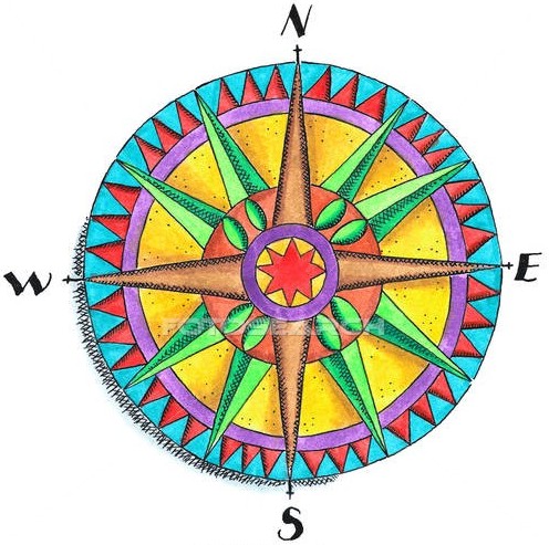 |
|
|
Holdenhurst
St John the Evangelist
|
Holdenhurst
St John the Evangelist
|
|
1755 1760 1765 1770 1775 1780 1785 1790 1795 1800 1805 1810 1815 1820 1825 1830 1835
Corrections to Tinstaafl Transcripts