
England
& Wales Hardwicke Marriage Index
Marriages
1754 - 1837
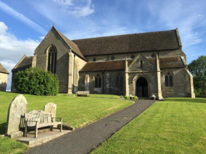
Pembridge St Mary
| |
England
& Wales Hardwicke Marriage Index |
The ParishThe parish of Pembridge lies in northwestern Herefordshire not too far from its border with neighbouring Radnorshire, and hence with Wales. Pembridge is located roughly 7 miles west of the market town of Leominster and sits on the A44 road that links Leominster with Kington and onwards into Wales. Pembridge, at one time of sufficient importance to have been granted a market in 1239 which has since lapsed, is nowadays merely a large village almost entirely built around a crossroads of the A44 with both northward and southward running lanes. Pembridge is an attractive village with many properties of the distinctive "black-and-white" appearance characteristic of the district. As a regional centre for trade and for the provision of specialist trades Pembridge supplemented that income largely from the wool & cloth trade. The wider parish is utilised primarily for the local beef herds of Herefordshire cattle with a substantial acreage also devoted to orchards serving the local cider industry, Pembridge's Dunkerton's Cider providing a local attraction in the form of its Cider Shop. Modern developments came and left Pembridge, the branch railway line linking Leominster & Kington having closed and been largely dismantled. Pembridge sits on the southern banks of the River Arrow which drains the parish eastwards, meeting firstly the Lugg at Leominster and then, after turning southwards, the Wye to the east of Hereford, from here a long journey to the outer Bristol Channel follows arriving through the port of Chepstow. Pembridge is sited at 110 metres above the sea in its valley setting, away from the valley land rises only gently to around 150 metres some 3 miles to the southwest in gently rolling terrain. Pembridge parish was one of the more extensive in its county, covering just under 6,300 acres it was more reminiscent of an upland parish in size, within that extensive acreage would have been supported a population of close to 1,300 parishioners. In Domesday times Pembridge was a holding of one Alfred of Marlborough, a modest rural place offering 15 ploughs supplemented by a mill. |
 |
lies
|
|
|
| Register No | Covering Dates | Deposited With | Register Style | Quality Standard | Comments |
| 1 | 5th May 1754 - 16th May 1795 | Herefordshire Archives & Record Centre - Reference - AA4/8 | Plain, ruled & margined book containing combined Banns & Marriages | Grade 1 Register - Few issues noted and a low likelihood of
misreads |
None |
| 2 | 25th July 1795 -13th August 1812 | Herefordshire Archives & Record Centre - Reference - AA4/9 | Plain, ruled & margined book containing combined Banns & Marriages | Grade 2 Register - not a perfect read but with a low likelihood of misreads | None |
| 3 | 20th January 1813 -1st June 1837 | Herefordshire Archives & Record Centre - Reference - AA4/10 | Standard Rose style preprinted and prenumbered Marriage register | Grade 2 Register - not a perfect read but with a low likelihood of misreads | None |
|
Staunton
on Arrow St Peter
|
Byton
St Mary
Shobdon St John |
Shobdon
St John
|
 |
Eardisland
St Mary
Dilwyn St Mary |
|
|
Almeley
St Mary
|
Almeley
St Mary
Sarnesfield St Mary Weobley St Peter & St Paul |
Weobley
St Peter & St Paul
|
1760 1770 1780 1790 1800 1810 1820 1830
Corrections to Tinstaafl Transcripts