
England
& Wales Hardwicke Marriage Index
Marriages
1754 - 1837
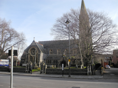
Hertford St Andrew
| |
England
& Wales Hardwicke Marriage Index |
The ParishHertford, the county town of its county of Hertfordshire, lies in the south of the county not too far from its border with neighbouring Essex, it sits roughly 21 miles north of the city of London and stands a mile west of the A10 road which links London with Cambridge. At one time the town consisted of 5 parishes but all are united nowadays into just 2 (All Saints and St Andrew). Hertford is a market town of some considerable age, its early foundation, like so many places, is lost in historical obscurity but clearly existed in Saxon times where twin forts, either side of the River Lea, were constructed to protect the infant town from Danish incursions. The arrival of the Normans saw a castle emerge on the site of the southern of these two forts and Hertford began to grow into a regional market. A charter for a market was granted by Charles II to consolidate the town's position as the market for trade and the home of specialist skills requiring a substantial population. Industry developed only scarcely and most were in trades linked to agriculture such as malting and milling. Modern developments have arrived in abundance, the Lee Navigation, Hertford being its terminus, arrived in 1767 and railways from the capital in 1843 again promoting growth but now of a more suburban nature, today both the A10 to Hertford's east and the A414 to its south have both been upgraded to highway standards to ease the once dreadful traffic issues. Hertford is drained eastwards and then south by the Lea which eventually makes its way through eastern London to meet the Thames at Blackwall, the latter as an estuary flows to the North Sea. Hertford is sited at between 40 metres at the Lea's bridges to 70 metres in its outer suburbs, to its south a few spots come close to 100 metres in relatively gentle terrain. Of the two remaining parishes St Andrew, which has subsumed both St Mary & St Nicholas parishes, largely covers the west & north of the town, it also included a stretch of rural countryside west of the town, and covered some 1,500 acres at its greatest extent, that area supporting a population of around 2,100 parishioners. Domesday Hertford was a holding of King William and recorded as a single entity, its population was, as a Saxon foundation, already large enough to place it amongst the largest 20% of settlements by population; its assets of an impressive 39 ploughs were supported by the usual meadows, pastures and woodland making for a wealthy holding for the King. |
 |
|
|
|
| Register No | Covering Dates | Deposited With | Register Style | Quality Standard | Comments |
| 1 | 22nd September 1755 - 1st January 1782 |
Hertfordshire Archives & Local Studies - Reference - D/P49/1/8 | Standard preprinted and self-numbered Marriage register with 4 entries per page | Grade 2 Register - not a perfect read but with a low likelihood of misreads | None |
| 2 |
17th January 1782 - 12th December 1812 |
Hertfordshire Archives & Local Studies - Reference -
D/P49/1/9 |
Standard preprinted and self-numbered Marriage register
with 3 entries per page |
Grade 2 Register - not a perfect read but with a low
likelihood of misreads |
None |
| 3 | 8th February 1813 - 11th May 1837 | Hertfordshire Archives & Local Studies - Reference - D/P49/1/10 | Standard Rose style preprinted and prenumbered Marriage register | Grade 3 Register - there are sufficient quality issues with this register to indicate that some misreads will occur albeit few in number | Poor handwriting might lead to a possibility of a few misreads |
|
Tewin
St Peter
|
Bramfield
St Andrew
|
|
|
Tewin
St Peter
|
 |
|
1760 1770 1780 1790 1800 1810 1820 1830
Corrections to Tinstaafl Transcripts