
England
& Wales Hardwicke Marriage Index
Marriages
1754 - 1837
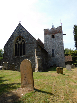
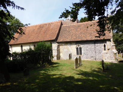
Crundale St Mary
| |
England
& Wales Hardwicke Marriage Index |
The ParishThe parish of Crundale lies in eastern central Kent about 5 miles northeast of the industrial town of Ashford. Crundale is a small village which sits just over a mile east of the A28 road which connects Ashford with Canterbury. Much of Crundale is built on a shallow side valley of that of the River Stour in an area rising to the downland of eastern Kent. A largely agricultural parish Crundale's economy would have been dominated by arable farming supplemented by the Kentish crops of orchards and hop farms. Lying on porous chalk there is little surface drainage until the main valley of the Stour is reached, this heads northeast through Canterbury to reach the North Sea through the port of Sandwich. Crundale is sited on a sloping site up the valley side rising from 60 metres to 100 metres through the rather scattered properties of the village. Crundale parish was fairly typically sized for its area, it covered almost 1,600 acres and would have supported a population of close to 300 parishioners. Crundale is not mentioned in Domesday Book . |
 |
|
|
|
| Register No | Covering Dates | Deposited With | Register Style | Quality Standard | Comments |
| 1 | 15th October 1755 - 19th December 1812 | Canterbury Cathedral Archives - Reference - U3/116/1/4 | Standard preprinted and self-numbered Marriage register with 4 entries per page | Grade 2 Register - not a perfect read but with a low likelihood of misreads | None |
| 2 | 11th October 1814 - 16th July 1836 | Canterbury Cathedral Archives - Reference - U3/116/1/5 | Standard Rose style preprinted and prenumbered Marriage register | Grade 2 Register - not a perfect read but with a low likelihood of misreads | None |
|
Godmersham
St Lawrence
|
Godmersham
St Lawrence
|
|
|
Godmersham
St Lawrence
|
 |
Petham
All Saints
Waltham St Bartholomew |
1760 1770 1780 1790 1800 1810 1820 1830
Corrections to Tinstaafl Transcripts