
England
& Wales Hardwicke Marriage Index
Marriages
1754 - 1837
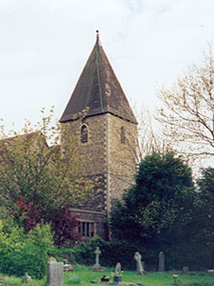
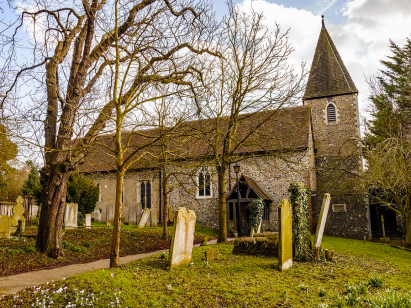
Darenth St Margaret
| |
England
& Wales Hardwicke Marriage Index |
The ParishThe parish of Darenth lies in northwestern Kent not too far from its northern coastline with the outer Thames Estuary. Darenth is located about 3 miles southeast of the town of Dartford and sits just over a quarter of a mile west of the B260 road which links Dartford with Meopham. Darenth is a small village lying along the eastern banks of the River Darent to which is grants its name, most properties lie parallel with the river either side of Darenth Hill which descends to cross the river from the B260. To the south lies the larger village of South Darenth which traditionally was shared between Darenth and Horton Kirby, that village has grown larger with the arrival of a railway. The river valley's flood-plain gave good pastureland for mainly cattle whilst on the chalk-rich higher ground arable would have dominated, in addition early gazetteers estimated almost 16% of the parish acreage as woodland which would have been managed for typical products such as poles, hurdles and brush, even today the marge green areas on the Ordnance Survey mapping of the parish. Darenth is almost swamped by modern developments which surround the parish, the railway line from London to Rochester arrived first and passes through the southern edges of South Darenth (actually Horton Kirby territory), to the north the A2 road from London to Rochester has been upgraded to fast dual-carriageway highway whilst to the west runs the modern M25 motorway part of London's ring of motorways. Darenth is drained northwards by the Darent which passes through Dartford to reach the Thames Estuary at Crayford Ness, the estuary carries water eastwards to the North Sea. Darenth is sited on rising ground between 10 and 40 metres above the sea, land continues rising eastwards away from the river and few spots reach in excess of 80 metres close to Darenth Wood. Darenth parish was typically sized for its area covering a little under 2,200 acres and supporting a population of close to 700 parishioners. In Domesday times Darenth was recorded as having 59 households which was sufficient to place today's small village into the top 20% of settlements in the book at that time, shared between Bishop Odo of Bayeux and the Archbishop of Canterbury Darenth had assets of 10 ploughs backed by typical meadows & woodland and no fewer than 5 mills. |
 |
|
|
|
| Register No | Covering Dates | Deposited With | Register Style | Quality Standard | Comments |
| 1 | 26th December 1754 - 21st December 1812 | Medway Archives & Local Studies Centre - Reference - P109/1/3 | Standard preprinted and self-numbered Marriage register with 4 entries per page | Grade 2 Register - not a perfect read but with a low likelihood of misreads | None |
| 2 | 26th April 1813 - 12th March 1837 | Medway Archives & Local Studies Centre - Reference - P109/1/14 | Standard Rose style preprinted and prenumbered Marriage register | Grade 3 Register - there are sufficient quality issues with this register to indicate that some misreads will occur albeit few in number | Poor handwriting may lead to one or two misreads |
|
Dartford
Holy Trinity
|
Stone
next Dartford St Mary the Virgin
|
Stone
next Dartford St Mary the Virgin
|
|
Sutton
at Hone St John the Baptist
|
 |
Stone
next Dartford St Mary the Virgin
|
|
Sutton
at Hone St John the Baptist
|
Horton
Kirby St Mary
|
Horton
Kirby St Mary
|
1760 1770 1780 1790 1800 1810 1820 1830
Corrections to Tinstaafl Transcripts