
England &
Wales Hardwicke Marriage Index
Marriages 1754 - 1837
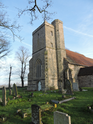
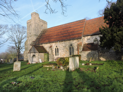
High
Halstow St Margaret
|
|
England &
Wales Hardwicke Marriage Index |
The ParishThe parish of High Halstow is in northern Kent, indeed the parish forms part of Kent's northern coast where it borders the Thames estuary. High Halstow is sited on the Hoo peninsula about a mile west of the main A228 road which connects Rochester with the Isle of Grain. High Halstow despite being a coastal parish actually sits over 2 miles inland from the sea wall as much land has been reclaimed for farming from the Thames. High Halstow, as its name suggests, sits on a ridge at a little above 50 metres above sea level with commanding views over the grazing marshes to the north. The village is centered on a crossroads of lanes to the west of the A228. This was a region of rather heavy clay soils and much of the parish was used as pasture, with arable fields located on the slopes of the ridge, especially on those areas reclaimed from the sea. The parish is quite a substantial one with almost 3,000 acres supporting almost 400 parishioners. The village is not, however, mentioned in Domesday Book. |
 |
|
|
|
| Register No | Covering Dates | Deposited With | Register Style | Quality Standard | Comments |
| 1 | 26th April 1756 - 29th July 1812 | Medway Archives Centre - Reference - P167/1/3 | Standard preprinted and self-numbered Marriage register with 4 entries per page | Grade 2 Register - not a perfect read but with a low likelihood of misreads | None |
| 2 | 23rd January 1813 - 6th October 1836 | Medway Archives Centre - Reference - P167/1/4 | Standard Rose style preprinted and prenumbered Marriage register | Grade 2 Register - not a perfect read but with a low likelihood of misreads | None |
|
Cliffe St Helen
Cooling St James |
 |
|
|
Frindsbury
All Saints
|
Hoo St Werburgh
|
Hoo St
Werburgh
Stoke St Peter & St Paul |
1760 1770 1780 1790 1800 1810 1820 1830
Corrections to Tinstaafl Transcripts