
England
& Wales Hardwicke Marriage Index
Marriages
1754 - 1837
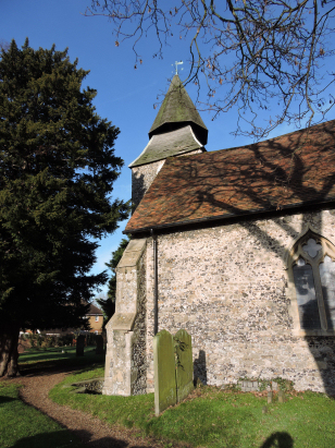
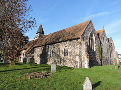
Upchurch St Mary the Virgin
| |
England
& Wales Hardwicke Marriage Index |
The ParishThe
parish of Upchurch lies in northern Kent, forming a stretch of
the county's northern coastline with the outer Medway estuary.
Upchurch is located roughly 4 miles east of the town of
Gillingham and sits about 2 miles north of the A2 (London to
Canterbury) road which follows the ancient Roman route of
Watling Street. Upchurch is a crossroads settlement, much
expended in modern times, centred on a junction of lanes by its
church. Growth has been particularly marked southwards towards
both the A2 and the railway line which borders the North Kent
coast. At the time of this transcript Upchurch would have been
primarily a farming community, its location on the salt-marshes
of North Kent would have varied its regime from the normal
arable with early gazetteers placing almost 1/3rd of the parish
acreage to salt-marsh grazing and a further 1/6th to standard
pasture. Today's Ordnance Survey map shows numerous orchards
around the village, a typical Kentish crop of apples and soft
fruits being grown. The wharfage at nearby Otterham Creek
provided the ability to ship agricultural produce and provided a
few with employment. Modern development in the form of that
railway line has boosted Upchurch's economy with a station at
nearby Rainham encouraging commuting into both the Medway towns
and wider afield too. As a coastal community numerous small
creeks drain into the nearby Medway Estuary and hence the outer
Thames Estuary too. Upchurch keeps its feet dry, however, being
sited at around 20 metres above the sea on a coastal plain that
rises gradually inland to local heights of just over 60 metres
on nearby Keycot Hill. Parishes with salt-marshes tend to be
larger than simple agricultural ones and Upchurch was no
exception, covering just under 3,600 acres it would have
supported a population of close to 500 parishioners. In Domesday
times Upchurch was, however, a slightly less significant place,
held by the ubiquitous Bishop Odo of Bayeux it could offer a
single plough but did possess a mill. |
 |
|
|
|
| Register No | Covering Dates | Deposited With | Register Style | Quality Standard | Comments |
| 1 | 4th July 1754 - 6th August 1811 | Kent History & Library Centre - Reference - P377/1/A/3 | Standard preprinted and self-numbered combined Banns & Marriage register with 4 entries per page | Grade 2 Register - not a perfect read but with a low likelihood of misreads | None |
| 2 | 8th October 1814 - 16th April 1837 | Kent History & Library Centre - Reference - P377/1/D/1 | Standard Rose style preprinted and prenumbered Marriage register | Grade 2 Register - not a perfect read but with a low likelihood of misreads | None |
|
|
|
|
|
Rainham
St Margaret
|
 |
Lower
Halstow St Margaret
|
|
Rainham
St Margaret
|
Hartlip
St Michael
|
Newington
next Sittingbourne St Mary
|
1760 1770 1780 1790 1800 1810 1820 1830
Corrections to Tinstaafl Transcripts