
England
& Wales Hardwicke Marriage Index
Marriages
1754 - 1837
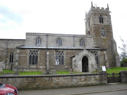
Edmondthorpe St Michael
| |
England
& Wales Hardwicke Marriage Index |
The ParishThe parish of Edmondthorpe is, by a small margin, the most easterly in Leicestershire and the parisj consequently has an extended border with neighbouring Rutland, a small portion also border Lincolnshire. Edmondthorpe is located roughly 6 miles north of the Rutland county town of Oakham and 7 miles east of Melton Mowbray. Edmondthorpe is a tiny place, little more than a hamlet which sits within an area devoid of major numbered roads, the closest such road being the B676 which sits some 3 or more miles north of Edmondthorpe and which connects Melton Mowbray with Colsterworth on the A1 (Great North Road). Most properties in Edmondthorpe lie along a narrow lane, running from the Wymondham to Teigh lane, in the direction of the ruined Edmondthorpe Hall, it is likely that the parish was a closed parish with most land in the hands of single land-holder who restricted inbound migration. The countryside hereabouts is classic "hunting country", small fields, mainly set to pasture, with tall hedged boundaries. Modern developments have come to Edmondthorpe, however, the Oakham Canal runs just south of the hamlet albeit is no longer used, whilst the Oakham to Melton Mowbray rail line skirts the western edge of the parish. Edmondthorpe is drained westwards by small tributaries of the River Eye which is met just beyond the rail line, the Eye morphs into the Wreake then joins the Soar at Leicester followed by the Trent at Long Eaton, here things turn back east on a long journey to the North Sea arriving through the Humber Estuary. Edmondthorpe is sited at around 110 metres above the sea in undulating countryside which reaches spot heights of 140 metres to the northeast. Edmondthorpe parish was fairly typically sized for its area, covering just under 1,700 acres it would have supported a population of close to 250 parishioners. In Domesday times Edmondthorpe was a holding of Henry de Ferrers and a profitable one too, offering 21 ploughs and some meadows to its landholder. |
 |
|
|
|
| Register No | Covering Dates | Deposited With | Register Style | Quality Standard | Comments |
| 1 |
4th June 1754 - 15th November 1777 |
Leicestershire & Rutland Record Office - Reference -
DE670/5 |
Standard preprinted and self-numbered combined Banns &
Marriage register with 4 entries per page |
Grade 2 Register - not a perfect read but with a low
likelihood of misreads |
None |
| 2 | 29th May 1778 - 10th November 1812 | Leicestershire & Rutland Record Office - Reference - DE670/4 | Standard preprinted and self-numbered Marriage register with 3 entries per page | Grade 2 Register - not a perfect read but with a low likelihood of misreads | None |
| 3 | 15th March 1813 - 14th December 1837 | Leicestershire & Rutland Record Office - Reference - DE670/6 | Standard Rose style preprinted and prenumbered Marriage register | Grade 2 Register - not a perfect read but with a low likelihood of misreads | None |
|
Wymondham
St Peter
|
Wymondham
St Peter
|
South
Witham St John the Baptist, Lincolnshire
|
|
Whissendine
St Andrew, Rutland
|
 |
South
Witham St John the Baptist, Lincolnshire
Thistleton St Nicholas, Rutland |
|
Whissendine
St Andrew, Rutland
|
Teigh
Holy Trinity, Rutland
|
Market
Overton St Peter & St Paul, Rutland
|
1760 1770 1780 1790 1800 1810 1820 1830
Corrections to Tinstaafl Transcripts