
England
& Wales Hardwicke Marriage Index
Marriages
1754 - 1837
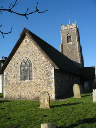
Eaton St Andrew
| |
England
& Wales Hardwicke Marriage Index |
The ParishThe parish of Eaton lies in eastern central Norfolk roughly 3 miles southwest of the medieval city of Norwich. Eaton sits on the former route of the A11, which, thankfully, now finds a new route passing the former village, connects Norwich via Thetford and on to London. Whilst Eaton was, at the time of this transcript, a separate crossroads village sitting on the A11, it was separated from its twin settlement of Cringleford, across the Yare, by a narrow humped bridge, a source of immense traffic congestion until the A11 was re-routed. Early maps show Eaton grouped around the crossroads formed by Bluebell Road and Church Lane with the main road and separated from the expanding city by nurseries, fields and allotments with even a lime works within today's golf course. Over the centuries Norwich has engulfed Eaton such that it is merely a suburb of this urban area, albeit the crossroads forms still the centre of this village within a suburb. Like most Norfolk parishes Eaton would have primarily been an arable farming area, some market gardening would have occurred to support the nearby city and the water-meadows of the Yare valley would have provided some pasture. The corn mill it shared with Cringleford provided some variation in employment. Today it is an integral part of the wider city and contiguous with the urban area, merely a suburb and dormitory. The Yare drains the parish southwards, passing around Norwich and then east to meet the North Sea through the port of Great Yarmouth. Eaton is sited at between 10 and 30 metres on a rising site away from the river, land continues to rise gently toward the city reaching local high points of around 34 metres in places. Eaton parish was fairly typically sized for an east Norfolk rural parish, covering close to 1,300 acres it would have supported a population of close to 500 parishioners, many thousands more today. In Domesday times Eaton was a holding of King William, himself, a modest rural manor offering just 4 ploughs, some meadow & woodland and a mill plus that which was shared with Cringleford. |
 |
|
|
|
| Register No | Covering Dates | Deposited With | Register Style | Quality Standard | Comments |
| 1 |
1st July 1754 - 25th December 1812 |
Norfolk Record Office - Reference - PD72/8 |
Standard preprinted and self-numbered Marriage register
with 3 entries per page |
Grade 3 Register - there are sufficient quality issues
with this register to indicate that some misreads will occur
albeit few in number |
Fading of this register is marked and may result in a few
misreads |
| 2 | 7th January 1813 - 24th May 1836 | Norfolk Record Office - Reference - PD72/9 | Standard Rose style preprinted and prenumbered Marriage register | Grade 3 Register - there are sufficient quality issues with this register to indicate that some misreads will occur albeit few in number | Fading is less than in the previous register but may still result in one or two misreads |
|
Earlham
St Mary
|
Earlham
St Mary
|
Heigham
St Bartholomew
|
|
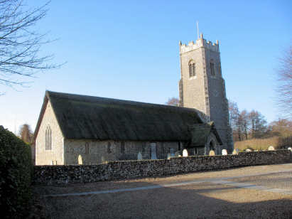
Cringleford
St Peter
|
 |
Lakenham
St John the Baptist
|
|
Cringleford
St Peter
|
Intwood
All Saints
|
Lakenham
St John the Baptist
|
1760 1770 1780 1790 1800 1810 1820 1830
Corrections to Tinstaafl Transcripts