England
& Wales Hardwicke Marriage Index
Marriages
1754 - 1837
Southburgh St Andrew
 |
England
& Wales Hardwicke Marriage Index |
The ParishThe parish of Southburgh lies in southern central Norfolk roughly 7 miles south of the market town of East Dereham, Southburgh sits in an area devoid of significant numbered roads, the closest such road being the B1135 which links East Dereham with Wymondham and which lies over 3 miles to Southburgh's east. Southburgh is atiny place with its only properties gathered about a crossroads a quarter of a mile west of its parish church, the wider parish contains scattered farms and cottages. Like most Norfolk parishes Southburgh would have been and still is dominated by arable farming, early gazetteers estimate that over 2.3rds of the parish acreage was arable and that percentage is probably higher today. Southburgh is drained eastwards by the Blackwater River which meets the infant Yare at Runhall, the Yare skirts the southern edges of Norwich before gathering with most eastern Norfolk rivers at Breydon Water before passing through Great Yarmouth to the North Sea. Southburgh is sited at around 40 metres above the sea in gentle terrain which rises slightly to the north from where a spot height of 66 metres near Letton Hall marks the highest ground. Southburgh parish covered just over 1,200 acres, a typical size in this county, and supported a population of around 300 parishioners. Southburgh is not mentioned in Domesday Book, |
 |
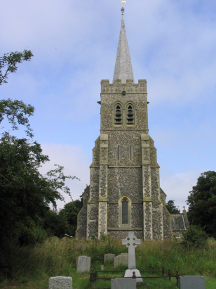
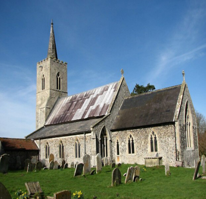
St
Andrew's church sits about a quarter mile east of the notional
centre of this tiny village on the northern side of Church Lane.
Churches with a spire are rare in Norfolk, towers being frequent
but few with spires, but that of St Andrew is a modern version
with the church being largely rebuilt between 1878 & 1882.
Early gazetteers describe the church as having a tower "in ruins"
and whilst mere restoration was initially contemplated it was a
full rebuild that eventually was required, A few pieces of the
original early church were reused, enough to show that the
predecessor had a chancel arch of c1300 and the nave came with a
mixture of both Decorated & Perpendicular styled tracery, in
short a typical age for a Norfolk rural church. The stand-out
feature is, of course, its tower complete with recessed spire, it
was completed in 1881. As a consequence of all this work the
church would probably be unrecognisable to the participants in
these marriages. Church Lane is rather narrow but the verge is
widened at the gap in the screening trees that serves as an
entrance. The churchyard forms an elongated oblong narrow from
north to south such that views are slightly restricted for
landscape portraits, the view from the west of the tower is,
however, exceptional. |
|

|
| Register No | Covering Dates | Deposited With | Register Style | Quality Standard | Comments |
| 1 |
25th September 1754 - 3rd April 1812 |
Norfolk Record Office - Reference - PD360/4 |
Standard preprinted and self-numbered Marriage register
with 3 entries per page |
Grade 3 Register - there are sufficient quality issues
with this register to indicate that some misreads will occur
albeit few in number |
Fading of this register may result in one or two misreads |
| 2 | 27th July 1813 - 1st April 1836 | Norfolk Record Office - Reference - PD360/5 | Standard Rose style preprinted and prenumbered Marriage register | Grade 3 Register - there are sufficient quality issues with this register to indicate that some misreads will occur albeit few in number | Fading of this register may result in one or two misreads |
|
Cranworth
St Mary the Virgin
|
||
|
Cranworth
St Mary the Virgin
Wood Rising St Nicholas |
 |
Hardingham
St George
|
|
Wood
Rising St Nicholas
|
Hingham
St Andrew
|
Hingham
St Andrew
|
1760 1770 1780 1790 1800 1810 1820 1830
Corrections to Tinstaafl Transcripts