
England
& Wales Hardwicke Marriage Index
Marriages
1754 - 1837
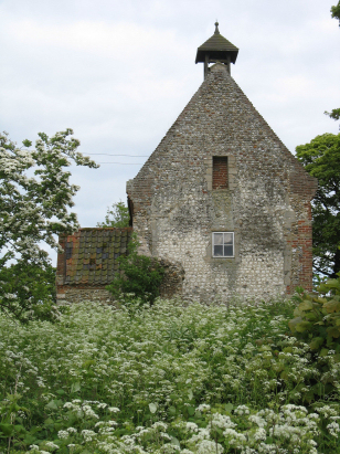
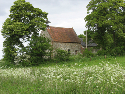
Waterden All Saints
| |
England
& Wales Hardwicke Marriage Index |
The ParishThe parish of Waterden lies in northwestern Norfolk about 6 miles northwest of the market town of Fakenham. Waterden sits just over a half mile east of the B1365 which connects Fakenham with Burnham Market. Waterden is a deserted medieval village, today there is only a couple of farms, the church and a scatter of cottages. Like most Norfolk parishes Waterden would have been, and still is, intensely arable with cereals the dominant crop. Sitting on a porous substrate there is little surface drainage, what little there is makes its way westward to join the River Burn, heading northwards to reach the North Sea through Burnham Overy Staithe. Waterden is sited at around 40 metres above the sea in gently rolling countryside that rises to 80 metres further east. Norfolk has many small parishes and Waterden is one of the smaller, covering just under 800 acres it would have supported a population of fewer than 50 souls. In Domesday times Waterden was equally small, a holding of William de Warenne it could muster just a pair of ploughs. |
 |
|
|
|
| Register No | Covering Dates | Deposited With | Register Style | Quality Standard | Comments |
| 1 |
5th October 1755 - 20th February 1811 |
Norfolk Record Office - Reference - PD593/3 |
Standard preprinted and self-numbered Marriage register
with 3 entries per page |
Grade 2 Register - not a perfect read but with a low
likelihood of misreads |
None |
|
South
Creake St Mary the Virgin
|
Great
Walsingham St Peter
|
|
|
South
Creake St Mary the Virgin
|
 |
North
Barsham All Saints
|
|
South
Creake St Mary the Virgin
|
North
Barsham All Saints
|
Corrections to Tinstaafl Transcripts