
England &
Wales Hardwicke Marriage Index
Marriages 1754 - 1837
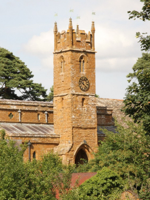
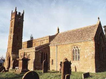
Balscote
St Mary Magdalene
|
|
England &
Wales Hardwicke Marriage Index |
The ParishThe chapelry of Balscote, sometimes rendered Balscott, lies in the extreme north of Oxfordshire not too far from both borders with neighbouring Warwickshire & Northamptonshire. Balscote is located about 5 miles west of the market town of Banbury, it is a chapelry of the wider parish of Wroxton. Balscote is a small and compact village situated a half mile south of the A422 road which links Banbury with the Warwickshire town of Stratford upon Avon. Balscote would have largely earned its living from farming, a mixed regime with sheep rearing predominating. Balscote is drained by the infant Sor Brook which heads southeastwards joining the Cherwell south of Banbury, heading south the Cherwell meets the Thames at oxford and thence eastwards through the capital to the North Sea. Balscote is sited at around 150 metres above the sea and sits on something of a plateau with the nearby Sor Brook cut 25 metres deeper, local heights rise to a further 10 metres higher. Balscote was only consecrated as a full parish in 1821, then just over 600 acres were allocated from the wider parish of Wroxton, those 600 acres would have supported a population of close to 200 parishioners, albeit marriages prior to 1821 would have been recorded at Wroxton. In Domesday times Balscote was one of the many possessions of Bishop Odo of Bayeux, an equally small place offering just 3 ploughs and a small meadow. |
 |
|
|
|
| Register No | Covering Dates | Deposited With | Register Style | Quality Standard | Comments |
| 1 | 10th October 1821 - 20th June 1836 | Oxfordshire History Centre - Reference - PAR15/1/R3/1 | Standard Rose style preprinted and prenumbered Marriage register | Grade 2 Register - not a perfect read but with a low likelihood of misreads | None |
|
Alkerton
St Michael
|
||
|
Alkerton St
Michael
|
 |
|
|
Shutford
St Martin
|
Shutford St
Martin
|
Broughton
St Mary
|
Corrections to Tinstaafl Transcripts