
England
& Wales Hardwicke Marriage Index
Marriages
1754 - 1837
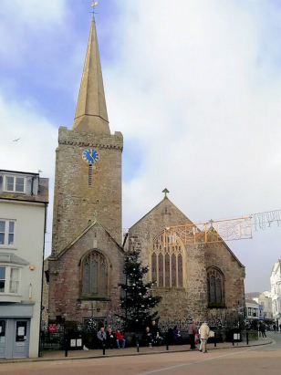
Tenby St Mary
| |
England
& Wales Hardwicke Marriage Index |
The ParishThe parish of Tenby (Dibych-y-Pysgoed in Welsh) lies in the extreme southeast of Pembrokeshire forming a stretch of the county's coastline with the outer Bristol Channel. Tenby is located roughly 10 miles east of the town of Pembroke and sits at the southern end of the A478 which connects it with Narberth and with the main artery of the region, the A40 from Swansea. Tenby is a port, market town and seaside resort combined into a triangular compact site formed around a harbour on the northern side of a low & rocky headland. From that focus the town expands inland, constrained southwards by the marshes flanking The Ritec and inland by rising land. Tenby has ancient roots, a site for Vikings and eventually Norman settlement it was soon fortified by the latter by placement of a castle and, in the 13th century, building of the town walls. These developments placed Tenby third amongst the walled towns of Wales behind Conway & Caernarvon. Throughout the medieval period Tenby flourished as a fishing & trading port and market town, its fish market was noted for the variety & quality of its produce, the port saw frequent trade with the northern coast of Devon & Cornwall across the narrow straights. The parish hinterland was fertile providing a mixture of grazing around The Ritec as well as arable farming whilst anthracite was worked from surface mines to its east. It was the arrival of the railway line linking Tenby not only with the industrial towns of South Wales but also with London that saw spectacular growth as a resort expanding the town considerably. Today Tenby is rightly viewed as one of the most attractive coastal towns in the UK, as Pevsner rightly states " a perfect picturesque addition to the landscape", with something for everyone, an attractive town full of nooks & crannies with quirky shops, a bathing resort with a splendid beach and, for the more energetic, a welcome stop on the arduous but highly scenic Pembrokeshire Coastal National Trail. As a coastal site numerous outfalls drain away water, mainly into The Ritec and the nearby sea. Tenby is sited at between sea level and 80 metres above it, the more northern suburbs, land continues rising inland in gently rolling countryside to local high spots to the west, along The Ridgeway, a geologically raised ridge of vertically standing hard strata, at 110 metres. At just over 2,000 acres Tenby parish was fairly typically sized for its area, within that acreage it would have supported a population of around 2,800 parishioners. Like most of Wales Tenby is not mentioned in Domesday Book which did not cover this area. |
 |
|
|
|
| Register No | Covering Dates | Deposited With | Register Style | Quality Standard | Comments |
| 1 | 2nd June 1754 - 20th October 1812 | Pembrokeshire Archives - Reference - HPR/78/9 |
Standard preprinted and self-numbered combined Banns & Marriage register with 3 entries per page | Grade 1 Register - Few issues noted and a low likelihood of misreads | None |
| 2 | 13th February 1813 - 28th April 1837 | Pembrokeshire Archives - Reference - HPR/78/10 | Standard Rose style preprinted and prenumbered Marriage register | Grade 1 Register - Few issues noted and a low likelihood of misreads | None |
|
St
Issels
|
|
|
|
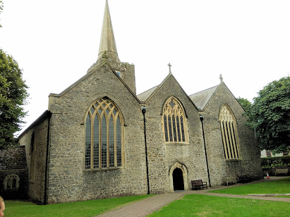
Gumfreston
St Lawrence
|
 |
|
|
Penally
St Nicholas
|
Penally
St Nicholas
|
|
1760 1770 1780 1790 1800 1810 1820 1830
Corrections to Tinstaafl Transcripts