England
& Wales Hardwicke Marriage Index
Marriages
1754 - 1837
Whitchurch St Alkmund
 |
England
& Wales Hardwicke Marriage Index |
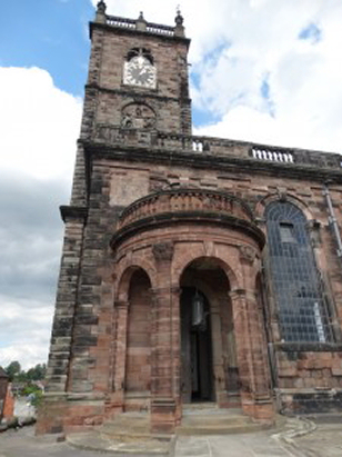
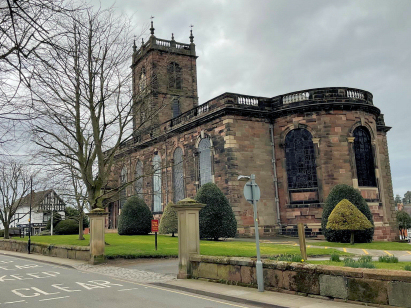
The ParishThe parish of Whitchurch lies in the extreme north of Shropshire forming not only an extensive stretch of the border with neighbouring Cheshire but also with neighbouring Flintshire, hence also Wales. Whitchurch is located roughly 20 miles north of the county's capital, Shrewsbury, and about the same distance east of the Denbighshire industrial town of Wrexham. Whitchurch is a large market town sitting at the fork of the A41, Shrewsbury to Chester road, and A49 which links it all the way to the M56 and to Warrington in Lancashire, to add to the status the A525, Newcastle under Lyme to Wrexham road, also crosses at the town. Whitchurch has a long history, proven by mid 1960s excavations to be the site of the principal Roman fort of the northern Marches, Mediolanum; the town's High Street still follows the line of the principal street of that Roman fort. Whitchurch grew through the granting of its market in the 14th century to become the principal centre for trade and specialist services not only serving northern Shropshire but also southern Cheshire & adjacent Flintshire. Within the wider parish earl gazetteers list no fewer than 14 townships within what is an extensive area dominated by arable farming. As well as supplying the market for the local arable and pastoral produce, Whitchurch specialised in the manufacture of shoes as well as producing oak acid from the numerous surrounding forests, malt & hops underpinned the market as the main traded crops making Whitchurch a noted brewing centre. Modern developments arrived in abundance, the extension of the Ellesmere canal allowed produce to join the canal network allowing trade all the way to the industrial centres of the Northwest, the Midlands and to the capital; railways arrived from Crewe as part of the line to Shrewsbury, granting Whitchurch its station which survives even to today, further lines to Chester and to Oswestry have, however, been dismantled. The routing of the town's A41 bypass has also improved the health & well-being of the town centre allowing it to remain the principal market town for its district. A rather confusing local drainage pattern eventually resolves into a discernible trend northeastwards to join the River Weaver which turn water northwards to eventually meet the Mersey estuary to the west of Runcorn and hence to the Irish Sea. Whitchurch sits on fairly gentle terrain at around 100 metres above the sea, land only rises gently within the close distance with several "high" spots of almost 130 metres. Whitchurch parish, as already indicated, is very extensive, almost like a northern upland parish in extent, covering over 15,000 acres it would have supported a population of almost 6,400 parishioners, of whom slightly more than half would live within the town. In Domesday times Whitchurch, held by William de Warenne was already one of the largest 20% of settlements by population, its assets were small by comparison, 12 ploughs and some woodland, 2 further townships within the wider parish also merited an entry, Edgeley and Alkington, adding 2 further ploughs to the total. |
 |
|
|

|
| Register No | Covering Dates | Deposited With | Register Style | Quality Standard | Comments |
| 1 |
29th March 1754 - 29th December 1861 |
Shropshire Archives - Reference - P303/A/3/1 |
Standard preprinted and self-numbered combined Banns &
Marriage register with 4 entries per page |
Grade 3 Register - there are sufficient quality issues
with this register to indicate that some misreads will occur
albeit few in number |
Fading of this register may result in one or two misreads |
| 2 | 1st January 1762 - 13th October 1776 | Shropshire Archives - Reference - P303/A/3/2 | Plain, ruled book containing combined Banns & Marriages | Grade 1 Register - Few issues noted and a low likelihood of
misreads |
None |
| 3 | 24th November 1776 - 16th December 1800 | Shropshire Archives - Reference - P303/A/3/3 | Standard preprinted and self-numbered Marriage register with 4
entries per page |
Grade 2 Register - not a perfect read but with a low likelihood of
misreads |
None |
| 4 | 18th December 1800 - 31st December 1812 | Shropshire Archives - Reference - P303/A/3/4 | Standard preprinted and self-numbered Marriage register with 4 entries per page | Grade 2 Register - not a perfect read but with a low likelihood of
misreads |
None |
| 5 | 1st January 1813 - 10th June 1837 | Shropshire Archives - Reference - P303/A/3/5 | Standard Rose style preprinted and prenumbered Marriage register | Grade 2 Register - not a perfect read but with a low likelihood of
misreads |
None |
|
Acton St Mary,
Cheshire
Audlem St James, Cheshire |
||
 |
||
|
Prees
St Chad (detached)
|
Wem St
Peter & St Paul
Prees St Chad |
Prees
St Chad
|
1755 1760 1765 1770 1775 1780 1785 1790 1795 1800 1805 1810 1815 1820 1825 1830 1835
Corrections to Tinstaafl Transcripts