
England
& Wales Hardwicke Marriage Index
Marriages
1754 - 1837
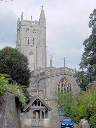
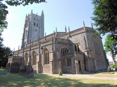
Blagdon St Andrew
| |
England
& Wales Hardwicke Marriage Index |
The ParishThe parish of Blagdon lies in northern Somerset roughly 12 miles east of the coastal resort of Weston Super Mare. Blagdon sits on the A368 road which links Weston Suoer Mare with the spa town of Bath and runs along the northern edges of the Mendip Hills. Blagdon has a substantial presence along the A368 but also along 3 main lanes, two run north towards Blagdon Lake whilst the third climbs the northern slopes of the Mendips, a more modern development mirrors the easternmost northern lane too. Blagdon's position on the northern edges of the largely limestone range of hills, The Mendips, meant that extractive industries were important income generators, building stone and burning for lime were the chief uses of the limestone whilst an obscure zinc ore, calamine, was also mined. Farming across the range of geology also varied, the limestone areas favouring pastures of, mainly, sheep whilst lower clays & sandstone supported cereal production, in all a varied economy. Railway construction was prevalent in the area, mainly serving the quarries but all are nowadays closed and largely dismantled. Drainage off the Mendips is largely sub-surface due to the porous limestone but along the northern edges runs the River Yeo, the main feeder of Blagdon Lake, artificially grown as a reservoir serving the populous of nearby Bristol, the Yeo heads off northwestwards to reach the outer Bristol Channel north of Weston super Mare. Blagdon occupies a steeply rising site, its lowest properties sit at 70 metres above the sea whilst its uppermost ones are a 100 metres higher, continuing the steep slope onto the tops of the Mendips the local high point of Beacon Batch sits at 325 metres dominating the views to Blagdon's south. Blagdon parish, at around 4,000 acres was significantly more extensive than most Somerset parishes, within that acreage a population of close to 1,200 parishioners would have found income and support. In Domesday times Blagdon was a mid-sized settlement held by one Serlo de Burcy, its assets of 9 ploughs, the usual meadows, pastures & woodland and all was supplemented by 2 mils making for a prosperous hut not large community. |
 |
|
|
|
| Register No | Covering Dates | Deposited With | Register Style | Quality Standard | Comments |
| 1 |
12th May 1754 - 14th July 1812 |
Somerset Archives & Local Studies - Reference -
D/P/blag/2/1/5 |
Standard preprinted and self-numbered Marriage register
with 4 entries per page |
Grade 3 Register - there are sufficient quality issues
with this register to indicate that some misreads will occur
albeit few in number |
Poor handwriting for the first 10 years may result in one or
two misreads, thereafter matters are OK |
| 2 | 7th July 1813 - 2nd May 1837 | Somerset Archives & Local Studies - Reference - D/P/blag/2/1/8 | Standard Rose style preprinted and prenumbered Marriage register | Grade 2 Register - not a perfect read but with a low likelihood of misreads | None |
|
Wrington
All Saints
Butcombe St Michael |
||
|
Burrington
Holy Trinity
|
 |
|
1760 1770 1780 1790 1800 1810 1820 1830
Corrections to Tinstaafl Transcripts