
England
& Wales Hardwicke Marriage Index
Marriages
1754 - 1837
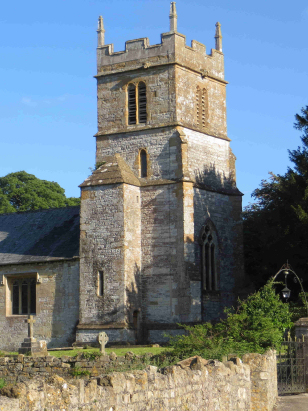
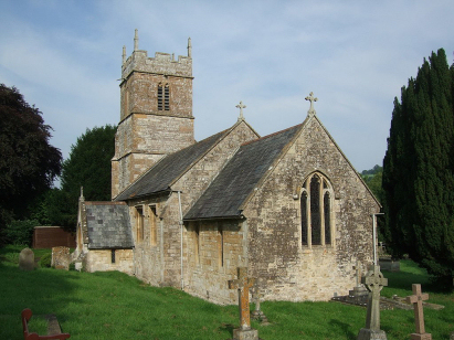
Dunkerton All Saints
| |
England
& Wales Hardwicke Marriage Index |
The ParishThe parish of Dunkerton lies in northeastern Somerset roughly 5 miles southwest of the city of Bath. Dunkerton is located immediately west of the A367 road which links Bath with Shepton Mallet. Today's Dunkerton is a sahadow of its former self, a small village strung out along the valley of the Cam Brook with most properties gathered around a junction of lanes north of the brook and church. At the time of this transcript Dunkerton was a small mining community, part of the Somerset coal-field and supporting a substantial population. The wider parish, and it was relatively small, was largely farmed with almost equal parts arable and pastoral. The modern developments which served the mines of this area around Clutton have largely disappeared, a railway line connecting the mines into Bath having closed and been largely dismantled. Today there is little evidence beyond the occasional overgrown spoil heap of the area's industrial past. Dunkerton is drained eastwards by the Cam Brook which joins the Wellow Brook and then the Avon in swift succession, the Avon passes through both Bath and Bristol to reach the outer Bristol Channel under its iconic bridge. Dunkerton is sited at around 60 metres above the sea in an incised valley where steep hillsides rise either side to a local high spot of 173 metres to the west of nearby Tunley As already noted Dunkerton parish was one of the smaller in its county, covering just under 1,200 acres it would have nevertheless have supported a population, now largely gone, of around 800 parishioners. In Domesday times Dunkerton was also a large rural settlement held by a Saxon survivor Turstin son of Rolf it could muster 8 ploughs, the usual meadows & pasture and had a mill powered by the Cam Brook. |
 |
|
|
|
| Register No | Covering Dates | Deposited With | Register Style | Quality Standard | Comments |
| 1 |
17th June 1754 - 24th September 1812 |
Somerset Archives & Local Studies - Reference -
D/P/dunk/2/1/2 |
Standard preprinted and self-numbered combined Banns &
Marriage register with 4 entries per page |
Grade 2 Register - not a perfect read but with a low
likelihood of misreads |
None |
| 2 | 26th April 1813 - 5th March 1837 | Somerset Archives & Local Studies - Reference - D/P/dunk/2/1/4 | Standard Rose style preprinted and prenumbered Marriage register | Grade 2 Register - not a perfect read but with a low likelihood of misreads | None |
|
Priston
St Luke
|
English
Combe St Peter
|
English
Combe St Peter
|
|
Priston
St Luke
Camerton St Peter |
 |
Combe
Hay
Wellow St Julian |
|
Camerton
St Peter
|
Camerton
St Peter
|
Wellow
St Julian
|
1760 1770 1780 1790 1800 1810 1820 1830
Corrections to Tinstaafl Transcripts