
England
& Wales Hardwicke Marriage Index
Marriages
1754 - 1837
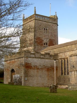
East Harptree St Lawrence
| |
England
& Wales Hardwicke Marriage Index |
The ParishThe parish of East Harptree lies in northern Somerset roughly 8 miles north of the city of Wells and sitting on the northern slopes of the Mendip Hills. East Harptree sits on and mainly southwest of the B3114 road, a linking road joining the A39 (Bath to Wells) road with the A368 (Bath to Weston super Mare) road. East Harptree is a linear village with a small presence on the B3114 but its main road climbs steadily southwestwards onto the Mendip Hills lined with properties for almost a mile, it is flanked by twin side lanes also lined with properties. East Harptree is a parish which was heavily involved in the extractive industries, the Mendip Hill provided high quality limestone for decorative work in building but it was the associated minerals which attracted miners with both lead and manganese the main attractions. As a consequence the northern slopes of the Mendips are bestrewn with, mainly abandoned, mine-shafts. The wider parish was primarily a pastoral one with early gazetteers estimating as much as 80% of the total acreage as set to pasture. East Harptree is drained northwards by a tributary of the infant River Chew which joins many others in the modern Chew Valley Lake reservoir not too far to the north, a major wildlife asset as well as a source of water for nearby Bristol & Bath, emerging from the reservoir the Chew turns northeast to meet the Avon at Keynsham before passing through its iconic gorge to the outer Bristol Channel. East Harptree sits on a steeply rising site, the few properties on the B3114 standing at around 80 metres above the sea whilst those at the southwestern end are at 150 metres, land continues to rise onto the Mendip's top reaching 290 metres at Eaker Hill and 294 at the Devil's Punch Bowl. East Harptree parish was more extensive than most Somerset parishes, covering just under 2,600 acres it would have supported a population of close to 750 parishioners. In Domesday times East Harptree was shared between Bishop Geoffrey of Coutances and Count Robert of Mortain, collectively their assets amounted to 9 ploughs, extensive meadows, pasture & woodland and each had control of a mill making for a relatively prosperous settlement even then. |
 |
|
|
|
| Register No | Covering Dates | Deposited With | Register Style | Quality Standard | Comments |
| 1 |
5th November 1754 - 15th October 1812 |
Somerset Archives & Local Studies - Reference -
D/P/E.Harp/2/1/4 |
Standard preprinted and self-numbered Marriage register
with 4 entries per page |
Grade 2 Register - not a perfect read but with a low
likelihood of misreads |
None |
| 2 | 3rd June 1813 - 12th December 1836 | Somerset Archives & Local Studies - Reference - D/P/E.Harp/2/1/5 | Standard Rose style preprinted and prenumbered Marriage register | Grade 2 Register - not a perfect read but with a low likelihood of misreads | None |
|
West
Harptree St Mary
|
West
Harptree St Mary
|
|
|
West
Harptree St Mary
|
 |
|
|
Chewton
Mendip St Mary Magdalene
|
Chewton
Mendip St Mary Magdalene
|
Chewton
Mendip St Mary Magdalene
|
1760 1770 1780 1790 1800 1810 1820 1830
Corrections to Tinstaafl Transcripts