
England
& Wales Hardwicke Marriage Index
Marriages
1754 - 1837
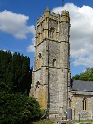
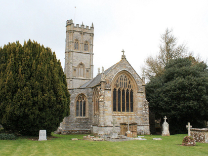
Muchelney St Peter & St Paul
| |
England
& Wales Hardwicke Marriage Index |
The ParishThe parish of Muchelney lies in the southern portion of central Somerset roughlu 11 miles southwest of Glastonbury and 14 east of Taunton. Muchelney sits jusr over a mile south of the A372 road which links Langport through towards Ilchester. Sitting in the heart of the Somerset Levels and barely above sea level, Muchelney's internal geography is largely dictated by the shape of the low island on which it sits, an island which saw the foundation of its abbey which is the origin of the settlement. There is dispute over the origins with forged 13th century documents claiming the foundation by King Ine of Wessex as early as 693, it is proven, however, to have been in existence in 762 and a charter changing its association to the Benedictine order in 939. Like so many such abbeys it was leveled after dissolution and lost before excavations in 1873 refound the site. The abbey dominated the medieval economy of the parish but little changed with its dissolution, surrounded by vast areas of marshy ground which became subject to drainage efforts it naturally became grazing pasture and pastoral farming is probably still the major land-use. The parish is drained northwards by the River Parrett the short distance to join the Yeo at Langport, the two forming the Parrett onward to the sea arriving at the Bristol Channel through the port of Bridgwater. The highest point on Muchelney's small island reaches the lofty height of 16 metres, a more substantial height being that of the 77 metres reached westwards at nearby Curry Rivel. Muchelney parish was fairly typically sized at close to 1,600 acres it would have supported a population of close to 350 parishioners. In Domesday times the Abbey of Muchelney held the settlement, a small one at the time offering just 4 ploughs, the usual meadows, pastures and woodland, a sign of its watery environment was the presence of 2 profitable fisheries. |
 |
|
|
|
| Register No | Covering Dates | Deposited With | Register Style | Quality Standard | Comments |
| 1 |
28th September 1754 - 28th November 1782 & 28th May
1788 - 27th July 1812 |
Somerset Archives & Local Studies - Reference -
D/P/much/2/1/4 |
Standard preprinted and self-numbered Marriage register
with 4 entries per page |
Grade 2 Register - not a perfect read but with a low
likelihood of misreads |
None |
| 2 | 1st June 1784 - 8th March 1788 | Somerset Archives & Local Studies - Reference - D/P/much/2/1/3 | Standard preprinted and self-numbered Marriage register with 4 entries per page | Grade 2 Register - not a perfect read but with a low likelihood of misreads | None NB this register is bundled together with a preprinted baptismal & burials register as a single archival deposit |
| 3 | 4th July 1814 - 11th May 1837 | Somerset Archives & Local Studies - Reference - D/P/much/2/1/5 | Standard Rose style preprinted and prenumbered Marriage register | Grade 2 Register - not a perfect read but with a low likelihood of misreads | None |
|
Huish
Episcopi St Mary
|
Huish
Episcopi St Mary
|
Long
Sutton Holy Trinity
|
|
Drayton
St Catherine
|
 |
Long
Load Christ Church
Martock All Saints |
|
Drayton
St Catherine
|
Kingsbury
Episcopi St Martin
|
Martock
All Saints
|
1760 1770 1780 1790 1800 1810 1820 1830
Corrections to Tinstaafl Transcripts