
England
& Wales Hardwicke Marriage Index
Marriages
1754 - 1837
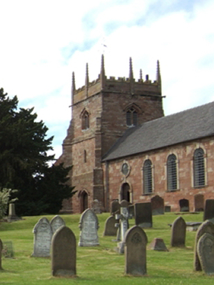
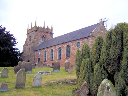
Forton All Saints
| |
England
& Wales Hardwicke Marriage Index |
The ParishThe parish of Forton lies in the extreme west of Staffordshire forming a stretch of the county's border with neighbouring Shropshire. Forton is located just over a mile northeast of the Shropshire market town of Newport and stands on the A519 road which links Newport with Eccleshall. Forton, itself, is a small crossroads settlement on the A519 whilst larger settlements within the parish included Sutton, also a crossroads village but larger, also standing on the A519 to the northeast and also the linear settlement of Meretown running south from Forton. The major element of the parish was, however, the estate of Aqualate Park, the estate of the 17th century manor house built for the Scrymsher family, passing onwards to the Bougheys, which stands in extensive manicured parkland including the expanse of Aqualate Mere over a mile in length and half that in width. Almost all land was owned by the Lord of the Manor and the parish economy, therefore, was driven by the needs of the estate with pastoral farming the dominant activity. Modern developments came and went from the parish, a branch canal once connected Newport to the Shropshire Union but has since closed and only sections remain. Forton is drained westwards by the Strine Brook which eventually meets the River Tern near Longdon on Tern from where water heads southwest and then south to meet the mighty Severn to the east of Shrewsbury, after passing though iconic Ironbridge and stately Worcester the Severn eventually reaches the sea through the Bristol Channel. Forton is sited at around 80 metres above the sea land rises only gently to the southeast to reach the local high spot of Windmill Bank at 127 metres. Forton parish, like many in the west Midlands was quite extensive covering just a bit less than 3,700 acres which would have supported a population of close to 750 parishioners. Whilst Forton was not recorded in Domesday Book the manor of Meretown was so recorded as a holding of King William which offered 11 ploughs, some woodland and also held a mill. |
 |
|
|
|
| Register No | Covering Dates | Deposited With | Register Style | Quality Standard | Comments |
| 1 |
11th October 1754 - 8th June 1812 |
Staffordshire History Centre - Reference - D4049/1/5 |
Standard preprinted and self-numbered combined Banns &
Marriage register with 4 entries per page |
Grade 2 Register - not a perfect read but with a low
likelihood of misreads |
None |
| 2 | 26th January 1813 - 28th May 1837 | Staffordshire History Centre - Reference - D4049/1/6 | Standard Rose style preprinted and prenumbered Marriage register | Grade 2 Register - not a perfect read but with a low likelihood of
misreads |
None |
|
Chetwynd
St Michael, Shropshire
|
Norbury
St Peter
|
Norbury
St Peter
|
 |
Norbury
St Peter
Gnosall St Lawrence |
|
|
Church Aston St Andrew, Shropshire
|
Sheriffhales
St Mary, Shropshire
|
Gnosall
St Lawrence
|
1760 1770 1780 1790 1800 1810 1820 1830
Corrections to Tinstaafl Transcripts