England
& Wales Hardwicke Marriage Index
Marriages
1754 - 1837
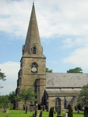
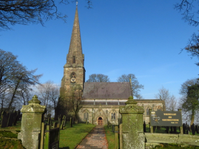
Grindon All Saints
 |
England
& Wales Hardwicke Marriage Index |
The ParishThe parish of Grindon lies in northeastern Staffordshire not too far from its border with neighbouring Derbyshire. Grindon is located about 8 miles east of the town of Leek and sits within Staffordshire's portion of the Peak District about 3 miles east of the B5053 road, this road is a link road joining the A523 (Leek to Ashbourne) road through to the A515 (Ashbourne to Buxton) road. Grindon is a compact, upland, village largely built around a triangle of lanes high above the deeply incised valley of the River Manifold. Most properties sit along the southernmost branch of that lane-triangle with the remainder of the parish dotted with farmsteads. The area sits upon thick bands of limestone, its quarrying was an important local trade, which has many subterranean passages for water-flow, show caves for visitors occur throughout the district. The limestone favours pastoral farming but there is also some arable in a mixture of farm types. Today Grindon earns much from its position attracting hikers and fishermen to the attractions of the Peak District National Park where Grindon is one of many accommodation providers. The Manifold drains the parish southwards, quickly augmented by input from the River Hamps, after meeting with the Dove the latter flows out of the hills to eventually join the Trent to the east of Burton upon Trent, the Trent then has a rather long journey to the sea arriving through the Humber Estuary. As an upland parish Grindon sits at the impressive height of 320 metres above the sea with land rising still further westwards to peak at 377 metres on nearby Grindon Moor. Like most upland parishes Grindon parish covered a broader area of low quality farmland, covering around 3,300 acres it would have supported a population of close to 400 parishioners. Grindon is mentioned in Domesday Book as a holding of one Roger of Stafford, it is, however, described merely as "waste", a term used in that book to describe un-developed land and referring to its upland nature. |
 |
|
|

|
| Register No | Covering Dates | Deposited With | Register Style | Quality Standard | Comments |
| 1 | 25th August 1854 - 1st October 1812 | Staffordshire History Centre - Reference - D924/1/3 | Standard preprinted and self-numbered Marriage register with 4 entries per page | Grade 2 Register - not a perfect read but with a low likelihood of misreads | None |
| 2 | 4th March 1813 - 2nd March 1837 | Staffordshire History Centre - Reference - D924/1/4 | Standard Rose style preprinted and prenumbered Marriage register | Grade 2 Register - not a perfect read but with a low likelihood of misreads | None |
|
Butterton
St Bartholomew
|
Butterton
St Bartholomew
|
Wetton
St Margaret
|
|
Leek St
Edward the Confessor
|
 |
Wetton
St Margaret
Ilam Holy Cross |
|
Waterfall
St James & St Bartholomew
|
Waterfall
St James & St Bartholomew
|
Ilam
Holy Cross
|
1760 1770 1780 1790 1800 1810 1820 1830
Corrections to Tinstaafl Transcripts