
England
& Wales Hardwicke Marriage Index
Marriages
1754 - 1837
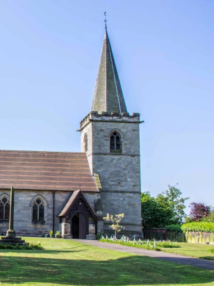
Rocester St Michael
| |
England
& Wales Hardwicke Marriage Index |
The ParishThe parish of Rocester lies in the extreme east of Staffordshire forming a lengthy stretch of the county's border with neighbouring Derbyshire, here formed by the course of the River Dove. Rocester is located roughly 5 miles north of the market town of Uttoxeter and sits immediately east of the B5030 road which heads northeast from Uttoxeter becoming the B5032 to reach Ashbourne in Derbyshire. Rocester is a large village which is constrained in it site by being placed on a narrow neck of land between the rivers Dove and Churnet, it forms a square of roughly a quarter mile each side. The position was obviously easily defensible so Rocester has an early origin as a Roman fort dating from the late 1st century to abandonment in c200. In medieval times the site attracted an Augustinian Abbey founded in the mid 12th century which flourished until the dissolution and disappeared its exact location and architecture not fully resolved. Much of the transcript period the village was mid-sized and relatively modest until modern developments started to arrive. Initially canals and then multiple railway lines, most have closed and disappeared from the landscape, brought investment as the famous Richard Arkwright established a cotton mill in the late 18th century to be followed in more modern times by the massive plant of JCB to the west. The wider parish was dominated by the lush meadows of the rivers with pastoral farming dominant therein with cereals grown on drier ground. The twin rivers of Dove and Churnet drain the parish southwards soon combining, as the Dove water turns southeast to eventually meet the Trent to the northeast of Burton Upon Trent and continuing on the long journey to the North Sea arriving through the Humber Estuary. Rocester is sited at around 90 metres above the sea to the west across the Churnet land rises into the fore-hills of the Peak District reaching heights of around 200 metres at nearby Hollington and higher still further westwards. Rocester parish covered close to 2,400 acres and supported a population of around 1,100 parishioners, a figure little exceeded even in the late 20th century. Domesday Rocester was a substantial manor shared between King William and Henry de Ferrers, it offered assets of 17 ploughs, meadows & woodland and there was a mill making for a wealthy holding. |
 |
|
|
|
| Register No | Covering Dates | Deposited With | Register Style | Quality Standard | Comments |
| 1 | 18th July 1754 - 6th December 1802 | Staffordshire History Centre - Reference - D925/1/3 | Nonstandard preprinted and self-numbered combined Banns & Marriage register it is non-standard in having 2 entries per page | Grade 2 Register - not a perfect read but with a low likelihood of
misreads |
None |
| 2 | 2nd June 1803 - 24th December 1812 | Staffordshire History Centre - Reference - D925/1/4 | Standard preprinted and self-numbered Marriage register with 4 entries per page | Grade 2 Register - not a perfect read but with a low likelihood of
misreads |
None |
| 3 | 11th January 1813 - 26th June 1837 | Staffordshire History Centre - Reference - D7204/1/4 | Standard Rose style preprinted and prenumbered Marriage register | Grade 2 Register - not a perfect read but with a low likelihood of
misreads |
None |
|
Alton
St Peter
|
Ellastone
St Peter
|
|
|
Alton
St Peter
Croxden St Giles |
 |
|
|
Checkley
St Mary
|
Doveridge
St Cuthbert, Derbyshire
|
1760 1770 1780 1790 1800 1810 1820 1830
Corrections to Tinstaafl Transcripts