
England
& Wales Hardwicke Marriage Index
Marriages
1754 - 1837
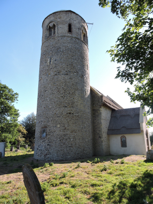
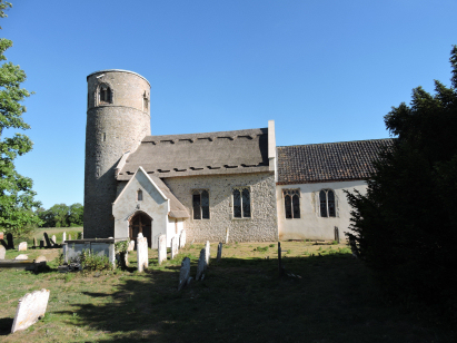
Herringfleet St Margaret
| |
England
& Wales Hardwicke Marriage Index |
The ParishThe parish of Herringfleet lies in the extreme northeast of Suffolk forming a stretch of the county's border, here formed by the course of the River Waveney, with neighbouring Norfolk. Herringfleet is located roughly 6 miles northwest of the port of Lowestoft and sits on the B1074 road which links Lowestoft with the Beccles to Gorleston road (the A143). Herringfleet is a sparsely populated parish with no discernible centre, a roughly pyramidal shaped set of lanes forms a boundary with the church on the west and the hall to the north, otherwise it is all scattered farms and cottages. Herringfleet's economy would have been a mixture of traditional East Anglian arable farming admixed with the exploitation of the Waveney's flood plain for grazing, thatch and wildfowling. The Waveney drains the parish northwards headed to join with the Norfolk Broadland rivers at Breydon Water and thence through the port of Great Yarmouth to the nearby North Sea. Herringfleet is sited at around 20 metres above the sea, a height which forms the highest ground within this flattish area of the county. Herringfleet parish covered around 1,200 acres so was towards the smaller end of Suffolk's scales, that acreage supporting a population of close to 200 parishioners. Whilst Herringfleet is mentioned in Domesday Book as a holding of King William its recorded asset is simply a small wood, home to a few pigs. |
 |
|
|
|
| Register No | Covering Dates | Deposited With | Register Style | Quality Standard | Comments |
| 1 |
17th June 1754 - 23rd November 1812 |
Norfolk Record Office - Reference - PD126/3 |
Standard preprinted and self-numbered Marriage register
with 3 entries per page |
Grade 2 Register - not a perfect read but with a low
likelihood of misreads |
None |
| 2 | 13th August 1813 - 15th March 1836 | Norfolk Record Office - Reference - PD126/4 | Standard Rose style preprinted and prenumbered Marriage register | Grade 2 Register - not a perfect read but with a low likelihood of misreads | None |
|
Fritton
St Edmund
|
Fritton
St Edmund
|
Fritton
St Edmund
|
 |
Ashby
St Mary
|
|
|
Aldeby
St Mary, Norfolk
Wheatacre All Saints, Norfolk Somerleyton St Mary
|
Somerleyton
St Mary
|
1760 1770 1780 1790 1800 1810 1820 1830
Corrections to Tinstaafl Transcripts