
England
& Wales Hardwicke Marriage Index
Marriages
1754 - 1837
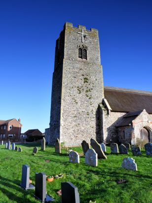
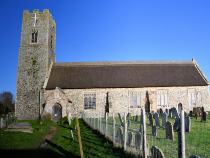
Pakefield St Mary & All Saints
| |
England
& Wales Hardwicke Marriage Index |
The ParishThe parish of Pakefield lies in the northeast of Suffolk, indeed it forms part of Suffolk's eastern North Sea coast. Pakefield is located about 2 miles south of the port of Lowestoft and today forms part of that port's extended urban area. Pakefield sits on the B1532 road (formerly the A12) as it heads southwards from Lowestoft to join the rerouted A12. Pakefield would have had a mixed economy, as a coastal settlement fishing would have been important, mainly from beach-hauled craft, as well as agriculture. Today it earns much of its living from its sandy beach. There are few streams draining the parish, those that do head northwards to reach Lake Lothing and the sea through Lowestoft. Pakefield is sited at just 2 metres above the sea and has an extensive beach frontage. Suffolk parishes are quite small and Pakefield was no exception, it covered just under 700 acres and would have supported a population of around 500 parishioners. In Domesday times Pakefield was largely held by the King, himself, with a small portion held by Earl Hugh of Chester. Pakefield could offer 14 ploughs as well as meadows and woodland. |
 |
|
|
|
| Register No | Covering Dates | Deposited With | Register Style | Quality Standard | Comments |
| 1 | 30th June 1754 - 27th July 1812 | Norfolk Record Office - Reference - PD551/9 | Standard preprinted and self-numbered Marriage register with 3 entries per page | Grade 1 Register - Few issues noted and a low likelihood of misreads | None |
| 2 | 16th February 1813 - 28th May 1837 | Norfolk Record Office - Reference - PD551/10 | Standard Rose style preprinted and prenumbered Marriage register | Grade 2 Register - not a perfect read but with a low likelihood of misreads | None |
|
Carlton
Colville St Peter
Kirkley St Peter |
|
|
 |
|
|
|
Gisleham
Holy Trinity
|
Gisleham
Holy Trinity
Kessingland St Edmund |
|
1760 1770 1780 1790 1800 1810 1820 1830
Corrections to Tinstaafl Transcripts