
England
& Wales Hardwicke Marriage Index
Marriages
1754 - 1837
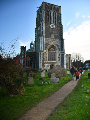
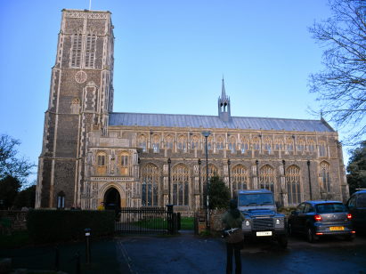
Southwold St Edmund
| |
England
& Wales Hardwicke Marriage Index |
The ParishThe parish of Southwold sits on Suffolk's eastern, North Sea, coast forming a short stretch of that coastline. Southwold is located roughly 10 miles east of the market town of Halesworth and 14 south of the port of Lowestoft. Southwold, itself, is also a market town and port which sits at the eastern end of the A1095, a short spur road connecting the town with the A12 (Lowestoft to Ipswich) road. Southwold has a long history, believed to have been founded by Danes c1010AD it was granted a market in 1490 by Henry VII. London was not the only place to have a great fire and in 1659 much of Southwold was destroyed by its own fire. Southwold made its historical debut some 13 years later when the Battle of Sole Bay took place between the English & Dutch immediately offshore, an event commemorated till modern times. Whilst functioning as a local market Southwold was principally a port, both fishing for mainly sole & herring and also for the import & export of goods. The constant siltation issues of this coastline has meant much labour to keep the port viable and today it is an important but secondary function. Today Southwold largely earns its living from tourism, described by Pevsner as "one of the happiest and most picturesque seaside towns in England". Not for Southwold the brash attractions of larger resorts it maintains its dignity whilst serving the visitors to beach, town and attractive local walks. The harbour-side fish & chips are recommended and the coast's beach huts sell for eye-watering sums reflecting the esteem in which Southwold is held. Modern developments came and went for Southwold, a light railway now dismantled forming a popular walk across the river to equally popular Walberswick. Southwold forms the exit to the North Sea of the River Blyth whilst Buss Creek almost cuts it off from the rest of the county to the north too. Southwold is sited at between sea level and 10 metres higher, land is gentle inland too rarely rising above 20 metres for many a mile. Strangely the parish of Southwold covered little more than the town and immediate surroundings, at just under 600 acres it was one of the smallest rural parishes in the county, within that small area would have been a population of close to 2,000 parishioners. In Domesday times Southwold was a tiny place, a holding of the Abbey of Bury St Edmunds offering just 5 ploughs and a small meadow, how times change. |
 |
|
|
|
| Register No | Covering Dates | Deposited With | Register Style | Quality Standard | Comments |
| 1 |
5th May 1754 - 18th May 1802 |
Suffolk Record Office - Ipswich - Reference - 153/D1/3 |
Standard preprinted and self-numbered Marriage register
with 4 entries per page |
Grade 4 Register - there are notable quality issues with
this register which may have resulted in many misreads |
Fading of this register is extreme with some entries almost
verging on invisible, it is likely there will be misreads and
there may be quite a few |
| 2 | 25th May 1802 - 9th November 1812 | Suffolk Record Office - Ipswich - Reference - 153/D1/4 | Standard preprinted and self-numbered Marriage register with 3 entries per page | Grade 4 Register - there are notable quality issues with this register which may have resulted in many misreads | Fading of this register is extreme with some entries almost verging on invisible, it is likely there will be misreads and there may be quite a few |
| 3 | 1st March 1813 - 22nd June 1837 | Suffolk Record Office - Ipswich - Reference - 153/D1/7 | Standard Rose style preprinted and prenumbered Marriage register | Grade 3 Register - there are sufficient quality issues with this register to indicate that some misreads will occur albeit few in number | Whilst fading is less marked than the pre-1813 registers it is still prevalent and a few misreads may occur as a result. |
|
Reydon
St Margaret
|
Reydon
St Margaret
|
|
|
Reydon
St Margaret
Walberswick St Andrew |
 |
|
|
Walberswick
St Andrew
|
Walberswick
St Andrew
|
|
1760 1770 1780 1790 1800 1810 1820 1830
Corrections to Tinstaafl Transcripts