
England &
Wales Hardwicke Marriage Index
Marriages 1754 - 1837
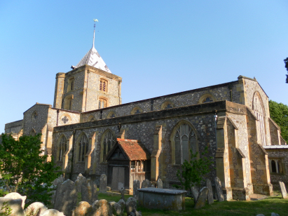
Arundel
St Nicholas
|
|
England &
Wales Hardwicke Marriage Index |
The ParishThe parish of Arundel lies in the south of Western Sussex about 4 miles from its English Channel coast. Arundel is located about 10 miles east of the town of Chichester and stands at the point where the River Arun completes it passage through the South Downs. Arundel is a market town and formerly a coastal trading port, despite the narrow passage upstream along the Arun. Arundel stands on the busy A27 road, Sussex's coastal main road, which connects Chichester with Brighton. Arundel was largely founded as a result of the building of the Norman castle on the excellently defended site of its bluff overlooking the valley. Built immediately after the Conquest by the Earl of Shrewsbury its siting here turned a relatively insignificant hamlet into a market town and burgh. Sadly Victorian mock-mediaeval rebuilding have turned it into something out a Disney fantasy rather than its early days as a defensive strong point protecting the south coast. The castle held a minor role in history, sheltering Queen Matilda from the forces of her rival Stephen during the post-Norman Civil War. As a local market Arundel would have acted for the immediate area offering the usual services to a largely agricultural hinterland, as a port it traded the local produce with other parts of the country as well as France, Ireland and the Low Countries. Today Arundel is something of a tourist attraction as well as market town, rather prettified in the same was as Windsor, bringing visitors fro all over. Modern developments aided that status, the London to Brighton & Chichester rail lines favouring the Arun Valley as a route avoided the challenging terrain of the Downs. The Arun drains the short distance to the English Channel, arriving through the port & town of Littlehampton. Arundel is sited between sea level and 40 metres above, the castle, church and cathedral standing at the southeastern end of a ridge of high ground rising to almost 150 metres within a couple of miles. Arundel parish was fairly typically sized for its area, covering just over 1,800 acres it would have supported a population close to 2,600 parishioners. In Domesday times and prior to the building of the castle it was an insignificant holding of the Earl of Shrewsbury offering only a mill and a fishery. |
 |
|
|
|
| Register No | Covering Dates | Deposited With | Register Style | Quality Standard | Comments |
| 1 | 15th May 1754 - 26th December 1812 | West Sussex Record Office - Reference - Par8/1/1/5 | Standard preprinted and self-numbered combined Banns & Marriage register with 4 entries per page | Grade 2 Register - not a perfect read but with a low likelihood of misreads | None |
| 2 | 9th February 1813 - 26th June 1837 | West Sussex Record Office - Reference - Par8/1/3/1 | Standard Rose style preprinted and prenumbered Marriage register | Grade 4 Register - there are notable quality issues with this register which may have resulted in many misreads | This register suffers markedly from fading making some entries almost illegible, thankfully an almost complete set of BTs exists and they are much more readable making this piece straightforward as a composite of the two sets of records |
|
Madehurst
St Mary Magdalene
|
Madehurst
St Mary Magdalene
|
Houghton
St Nicholas
|
|
Madehurst St
Mary Magdalene
|
 |
South Stoke
St Leonard
Lyminster St Mary Magdalene |
|
Binsted
St Mary
|
Torrington
St Thomas
|
Lyminster
St Mary Magdalene
|
1760 1770 1780 1790 1800 1810 1820 1830
Corrections to Tinstaafl Transcripts