
England
& Wales Hardwicke Marriage Index
Marriages
1754 - 1837
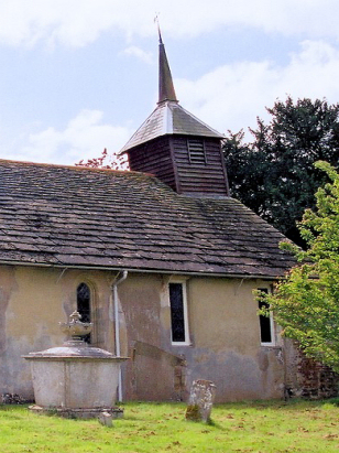
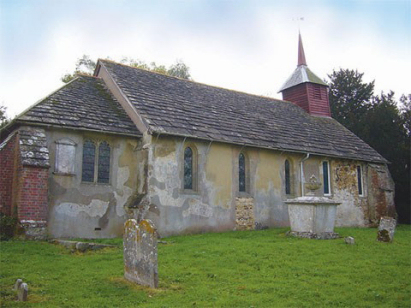
Shermanbury St Giles
| |
England
& Wales Hardwicke Marriage Index |
The ParishThe parish of Shermanbury lies in central Sussex about 7 miles west of the growing town of Burgess Hill. Shermanbury is a rather linear settlement built along the A281 road which connects Horsham with Brighton. Shermanbury is bordered to the south by the course of the River Adur but spreads along the A281 to the north for almost a mile, even so the parish church sits a half mile east in the grounds of Shermanbury Place. Sitting in the Weald Shermanbury would undoubtedly have exploited the iron-rich sandstones as well as farming providing a staple to the economy, today all trace of those rural industries has gone. The Adur drains the parish southwards to reach the nearby English Channel through the port of Shoreham by Sea. Shermanbury is sited at around 10 metres above the sea in gently undulating terrain. Shermanbury parish was a small parish for its area, it covered around 2,000 acres and would have supported a population of around 400 parishioners. In Domesday times Shermanbury was held by one William of Braose, it was a very small place offering just a pair of ploughs. |
 |
|
|
|
| Register No | Covering Dates | Deposited With | Register Style | Quality Standard | Comments |
| 1 | 11th October 1757 - 24th December 1812 | West Sussex Record Office - Reference - Par167/1/1/3 | Standard preprinted and self-numbered combined Banns & Marriage register with 4 entries per page | Grade 1 Register - Few issues noted and a low likelihood of misreads | None |
| 2 | 6th April 1813 - 23rd April 1835 | West Sussex Record Office - Reference - Par167/1/3/1 | Standard Rose style preprinted and prenumbered Marriage register | Grade 1 Register - Few issues noted and a low likelihood of misreads | None |
|
Cowfold
St Peter
|
Cowfold
St Peter
|
Cowfold
St Peter
|
|
West
Grinstead St George
|
 |
Woodmancote
St Peter
|
1760 1770 1780 1790 1800 1810 1820 1830
Corrections to Tinstaafl Transcripts