
England
& Wales Hardwicke Marriage Index
Marriages
1754 - 1837
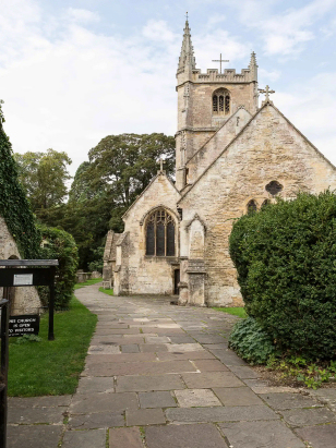
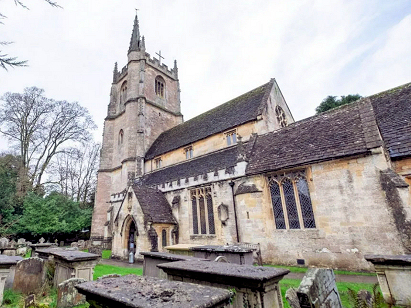
Castle Combe St Andrew
| |
England
& Wales Hardwicke Marriage Index |
The ParishThe parish of Castle Combe lies in northwestern Wiltshire not too far from its border with neighbouring Gloucestershire and roughly 6 miles northwest of the town of Chippenham. Castle Combe sits immediately west of the B4039 toad which links Chippenham through to Acton Turville and thence by way of the B4040 to Chipping Sodbury. Castle Combe has two distinct centres of population, the village itself occupies the bottom and steeply sloping valley sides of the By Brook with most properties gathered around the 15th century market cross, to the east and sitting on the B4039 is Upper Castle Combe roadside settlement made larger by the paraphernalia associated with the neighbouring motor racing circuit. Castle Combe is a county tourist village, a symphony in honey-coloured limestone properties, and is often crowded with visitors; most of the essential village services have been turned over into gift & antique shops and the like. The village has been regularly used as a backdrop for movies, TV shows and advertisements.There is genuine history as the castle was built in the early 13th century but dismantled before the end of the 14th leaving only its imprint on the landscape of the local golf course The limestone that underpins the village also made for sweet and short pastures ideal for the raising of sheep for the wool & the resulting cloth which made the area wealthy, today there is much more arable in the farming mix. The presence of the market cross is indicative of such aspirations which were never fully realised due to the proximity of Chippenham. Castle Combe is drain southwards by the By Brook which eventually turns southwestwards to meet the Avon at Batheaston, the Avon, of course, makes its way to the Bristol Channel under the iconic Brunel bridge of its gorge. Castle Combe occupies a range of elevations from 70 metres above the sea at the bridge to 130 metres in Upper Castle Combe, a few spots further westward rise to just over 160 metres at the county boundary with Gloucestershire but much of the area is a plateau more or less at Upper Castle Combe's height. Castle Combe parish was typically sized for its areas covering just over 1,500 acres and would have supported a population of around 600 parishioners. In Domesday times Castle Combe was a holding of Humphrey de L'Isle and had assets of 10 ploughs backed by typical meadows & woodlands, the rushing By Brook would also have supported the manor's 3 mills. |
 |
|
|
|
| Register No | Covering Dates | Deposited With | Register Style | Quality Standard | Comments |
| 1 |
5th May 1754 - 2nd December 1812 |
Wiltshire & Swindon Record Office - Reference -
PR058/1/6 |
Nonstandard preprinted and self-numbered Marriage register
with 3 entries per page, it is nonstandard in having separate
sections for marriages by Banns and by Licences |
Grade 2 Register - not a perfect read but with a low
likelihood of misreads |
None NB the odd sequencing is created by resorting the separate sections into date order |
| 2 | 11th February 1813 - 5th June 1836 | Wiltshire & Swindon Record Office - Reference - PR058/1/7 | Standard Rose style preprinted and prenumbered Marriage register | Grade 2 Register - not a perfect read but with a low likelihood of misreads | None |
|
Grittleton
St Mary
Hullavington St Mary |
||
|
North Wraxall St James
|
 |
Leigh
Delamere St Margaret
Yatton Keynell St Margaret |
|
North
Wraxall St James
|
Slaughterford
St Nicholas
|
Yatton
Keynell St Margaret
|
1760 1770 1780 1790 1800 1810 1820 1830
Corrections to Tinstaafl Transcripts