England
& Wales Hardwicke Marriage Index
Marriages
1754 - 1837
Ackworth St Cuthbert
 |
England
& Wales Hardwicke Marriage Index |
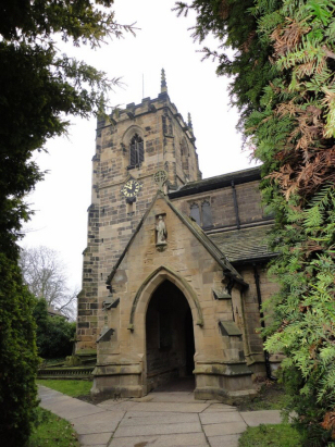
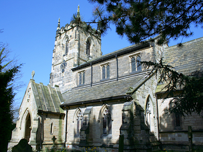
The ParishThe parish of Ackworth lies in southwestern Yorkshire roughly 3 miles south of the town of Pontefract. Ackworth consists of three distinct settlements, two of which sit upon the A628 road which links Pontefract with Barnsley. The original main settlement and which contains the parish church is High Ackworth, the more northern of the 3. High Ackworth, as its name suggests, stands on the slopes of a low hill at the point where the A628 performs a double right-angled bend to pass through, most properties line the main road. To the southeast sits Low Ackworth, a crossroads village situated between the A628 and the railway line. The largest of the three settlements is Ackworth Moor Top which developed as a pit village to exploit the mines and quarries of the south of the parish and has outgrown the 2 earlier settlements. It too is a crossroads settlement with its centre at the junction of the A628 with the A638 (Wakefield to Doncaster) road, it stretches for a mile westwards along the latter road and northwards for over a quarter mile. Ackworth at the time of this transcript was largely agricultural with a mixture of both farming methods, hand-loom weaving was also a major employer as was quarrying of the local sandstone, the coal mines of the south of the parish were deep and whilst they created a new community they have now all closed. Modern developments have come to the area, the above mentioned railway line linking Pontefract with Rotherham passes to the east whilst that from Wakefield to both Rotherham and Doncaster grazes the southern edges of the parish. Ackworth is drained eastwards by the infant River Went, once that river reaches the Fenland area of Yorkshire it becomes increasingly man-influenced eventually heading into the Aire though the straight cut of the Dutch River and thus to the North Sea through the Humber Estuary. In increasing height Low Ackworth sits at 30 metres, High Ackworth at 40 and Ackworth Moor Top at 50 metres above the sea, to the north of High Ackworth a water-tower stands at 76 metres the highest point for a few miles. Like many parishes in this area Ackworth was a large one covering just over 2,500 acres and supporting a population of around 1,800 parishioners. Ackworth is not mentioned in Domesday Book. |
 |
|
|

|
| Register No | Covering Dates | Deposited With | Register Style | Quality Standard | Comments |
| 1 |
24th November 1754 - 30th December 1802 |
West Yorkshire Archives Service - Wakefield - WDP77/1/1/3 |
Plain, ruled & bordered book containing Marriages |
Grade 4 Register - there are notable quality issues with
this register which may have resulted in many misreads |
This register is very badly faded with many entries almost
unreadable, extensive use of extant BTs have been used to obtain a
satisfactory transcript |
| 2 | 27th March 1803 - 27th December 1812 | West Yorkshire Archives Service - Wakefield - WDP77/1/3/1 | Standard preprinted and self-numbered Marriage register with 4 entries per page | Grade 2 Register - not a perfect read but with a low likelihood of misreads | None |
| 3 | 1st March 1813 - 11th June 1837 | West Yorkshire Archives Service - Wakefield - WDP77/1/3/2 | Standard Rose style preprinted and prenumbered Marriage register | Grade 2 Register - not a perfect read but with a low likelihood of
misreads |
None |
|
Featherstone
All Saints
|
Featherstone
All Saints
|
Pontefract
St Giles
|
 |
Pontefract
St Giles
|
|
|
Hemsworth
St Helen
|
Badsworth
St Mary
|
Badsworth
St Mary
|
1760 1770 1780 1790 1800 1810 1820 1830
Corrections to Tinstaafl Transcripts