
England
& Wales Hardwicke Marriage Index
Marriages
1754 - 1837
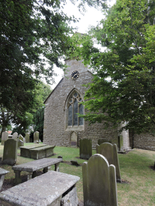
Bowes St Giles
| |
England
& Wales Hardwicke Marriage Index |
The ParishThe parish of Bowes lies in the extreme northwest of Yorkshire, indeed it forms part of the border with neighbouring Westmorland and is also very close to the border with County Durham. Bowes is located about 4 miles southwest of the Durham market town of Barnard Castle. Bowes sits, and was formerly traversed by the busy A66 road connecting the main east coast road (A1) with the main west coast road (A6) from London to Scotland. The A66 has ancient origins being created by the Roman occupation, Bowes was an important station on that route for the Roman garrisons of the north. Bowes was also fortified by the Norman invaders, albeit without mentioning Bowes in Domesday Book, Count Alan built Bowes castle in 1187 to control his extensive lands. Bowes is a large village and relatively compact being largely built along the former route of A66 which, thankfully now runs to the north. Bowes is very much an upland setting and the farming hereabouts would have been low intensity sheep rearing on the extensive moors, lead mining and quarrying of the local stone were also important employers. Today Bowes is an important stopping point on the Pennine Way National Trail and also a centre for the extensive grouse moors running from the village up to the Tan Hill Inn, reputed to be England's highest altitude inn. Bowes sits on the northern banks of the River Greta which drains the parish eastwards, it joins the Tees to the east of Barnard Castle and makes its way to the North Sea through the port of Teeside. Bowes, itself, is sited at around 290 metres above the sea and land rises steadily to all sides except eastwards to reach local heights in excess of 400 metres within a mile or two. Bowes parish was one of the largest by area in England covering over 18,000 acres of (largely) bleak moorland it still would have supported a population of around 850 parishioners. As already stated Bowes is not mentioned within Domesday Book which is sparse in its coverage of this northern area. |
 |
|
|
|
| Register No | Covering Dates | Deposited With | Register Style | Quality Standard | Comments |
| 1 | 7th October 1754 - 22nd December 1812 | Durham County Record Office - Reference - EP/Bow 1/5 | Plain, unruled book containing combined Banns & Marriages | Grade 3 Register - there are sufficient quality issues with this register to indicate that some misreads will occur albeit few in number | There are passages within this register where the segregation of entries is poor it is, therefore, possible that accidental omission may occur |
| 2 | 13th February 1813 - 6th March 1837 | Durham County Record Office - Reference - EP/Bow 1/6 | Standard Rose style preprinted and prenumbered Marriage register | Grade 3 Register - there are sufficient quality issues with this register to indicate that some misreads will occur albeit few in number | Poor handwriting within this register may lead to one or two misreads |
|
Romaldkirk
St Romald
|
Romaldkirk
St Romald
|
Romaldkirk
St Romald
|
|
Brough
St Michael, Westmorland
Kirkby Stephen St Stephen, Westmorland |
 |
|
|
Muker
St Mary
Grinton St Andrew |
Arkengarthdale
St Mary
|
Barningham
St Michael
|
1760 1770 1780 1790 1800 1810 1820 1830
Corrections to Tinstaafl Transcripts