
England
& Wales Hardwicke Marriage Index
Marriages
1754 - 1837
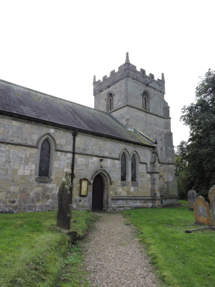
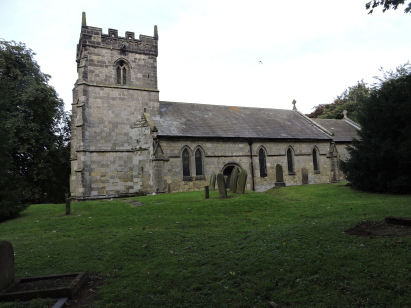
North Dalton All Saints
| |
England
& Wales Hardwicke Marriage Index |
The ParishThe parish of North Dalton lies almost centrally within the East Riding of Yorkshire, thus in the southern part of the overall county. North Dalton is located about 6 miles southwest of the market town of Driffield on the eastern edges of the Yorkshire Wolds. North Dalton sits on the B1246 road which connects Howden with the A614 road headed for Driffield. North Dalton is a small and compact village built largely around where the B road describes a sharp set of right-angled bends to pass through the village. The village centre is dominated by its large duck-pond on the eastern side of the B1246. The area is largely devoted to arable farming and this would have occupied the majority of the population at the time of this transcript too. The area is gently undulating and slopes markedly down to the eastern coastal lowlands of Holderness a few miles to the east. The area is largely made of calciferous rocks and their porosity makes for little surface drainage, what little there is is headed eastwards to join a man-made channel, the Wellspring Drain, which eventually joins the River Hull at Driffield and thence southwards to reach the Humber Estuary. North Dalton is sited at around 60 metres above sea level. The parish was of a fairly typical size for The Wolds, it would have covered just under 3,900 acres and supported a population of around 450 parishioners. In Domesday times the land was almost totally shared by Robert of Tosny & Count Robert of Mortain but interestingly a small piece was left in the Saxon hands of a gentleman named Otbert. The land carried 14 ploughs but little else is notified. |
 |
|
|
|
| Register No | Covering Dates | Deposited With | Register Style | Quality Standard | Comments |
| 1 | 30th March 1756 - 13th July 1812 | East Yorkshire Archives - Beverley - Reference -
PE63/5 |
Standard preprinted and self-numbered Marriage register with 4 entries per page | Grade 1 Register - Few issues noted and a low likelihood of misreads | None |
| 2 | 18th February 1813 - 29th December 1836 | East Yorkshire Archives - Beverley - Reference - PE63/6 | Standard Rose style preprinted and prenumbered Marriage register | Grade 2 Register - not a perfect read but with a low likelihood of misreads | None |
|
Huggate
St Mary
|
Huggate
St Mary
Kirkburn St Mary |
Kirkburn
St Mary
|
|
Warter
St James
|
 |
Bainton
St Andrew
|
|
Warter
St James
|
1760 1770 1780 1790 1800 1810 1820 1830
Corrections to Tinstaafl Transcripts