
England
& Wales Hardwicke Marriage Index
Marriages
1754 - 1837
Lythe St Oswald
| |
England
& Wales Hardwicke Marriage Index |
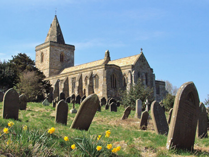
The ParishThe parish of Lythe lies in the extreme northeast of Yorkshire forming a lengthy stretch of the county's North Sea coastline. Lythe is located roughly 4 miles west of the port of Whitby and sits on the A174 road which connects Whitby with the metropolitan area of Teesside. Whilst Lythe village grants its name to the parish it is just a small village set around a T-junction and around a miles from the sea, within the extensive wider parish there are further settlements at Goldsborough & Kettleness, at Sandsend and Runswick Bay both on the coast and at the smaller inland hamlets of East & West Barnby. Despite the parish's northern location it was fertile and suitable for arable production but the parish's main income came from the extraction of alum from the underlying rocks, both Kettleness and Sandsend supported alum works from the 17th century onwards. Modern developments of a mineral railway line, hugging the clifftops, have now been dismantled however. Today tourism attracts many, to Runswick Bay and Sandsend for their beaches, for the coast generally for its scenery and also for its stretch of the Cleveland Way National Trail which follows that coastline. As a coastal parish numerous small, fast flowing, streams drain into the North Sea either at Deepgrove Wyke or at numerous spots around Runswick Bay. Lythe village sits at 140 metres above the sea whilst the wider parish rises from sea level to 197 metres on Potato Hill, to both south & west land rises to over 200 metres onto the edges of the North Yorkshire Moors. At almost 12,100 acres Lythe parish was very extensive, typical of a northern and upland parish, within that extensive acreage it would have supported a population of around 2,100 parishioners. In Domesday times 3 manors were recorded within Lythe parish, all 3 were held by Count Robert of Mortain but only Lythe, itself, recorded significant assets, 1 single plough was backed by the usual meadows & woodland. |
 |
|
|
|
| Register No | Covering Dates | Deposited With | Register Style | Quality Standard | Comments |
| 1 |
18th April 1754 - undated entry 1775 |
North Yorkshire Record Office - Northallerton - Reference
- PR/LY 1/5 |
Plain, ruled book containing Marriages |
Grade 2 Register - not a perfect read but with a low
likelihood of misreads |
None |
| 2 | 20th August 1775 - 25th March 1799 | North Yorkshire Record Office - Northallerton - Reference - PR/LY 1/6 | Standard preprinted and self-numbered Marriage register with 4 entries per page | Grade 2 Register - not a perfect read but with a low likelihood of
misreads |
None |
| 3 | 15th August 1799 - 23rd December 1812 | North Yorkshire Record Office - Northallerton - Reference - PR/LY 1/7 | Standard preprinted and self-numbered combined Banns & Marriage register with 4 entries per page | Grade 2 Register - not a perfect read but with a low likelihood of
misreads |
None |
| 4 | 1st February 1813 - 11th April 1837 | North Yorkshire Record Office - Northallerton - Reference - PR/LY 1/9 | Standard Rose style preprinted and prenumbered Marriage register | Grade 2 Register - not a perfect read but with a low likelihood of
misreads |
None |
|
Hinderwell
St Hilda
|
Hinderwell
St Hilda
|
|
|
Hinderwell
St Hilda
|
 |
|
|
Danby
St Hilda
|
Egton
St Hilda
|
1760 1770 1780 1790 1800 1810 1820 1830
Corrections to Tinstaafl Transcripts