
England
& Wales Hardwicke Marriage Index
Marriages
1754 - 1837
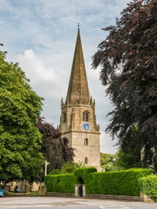
Masham St Mary
| |
England
& Wales Hardwicke Marriage Index |
The ParishThe parish of Masham lies in northern Yorkshire, within the North Riding but forming an extensive stretch of the border between it and West Riding. Masham is located roughly 10 miles northwest of the town of Ripon and 14 west of Thirsk and sits on the A6108 road which links Ripon with Leyburn. Masham has a favoured location, sitting on almost level ground formed between the confluence of the River Ure with the Burn, and is a mid-sized market town. The A6108 crosses the Ure and forms the northern edge of the town which forms a square of properties to its south, that original square has been added to by modern expansion but is still clear to see on maps, the eastern portion of the town is dominated by the broad square of the market place, Masham's crowning glory and a wonderful asset for the town. Whilst Masham is the main settlement, within the wider parish early gazetteers mention no fewer than 8 other townships such that the town itself holds merely 40% of the parish's population, a few of such being big enough to warrant the term village. Masham acquired its charter for a market in 1150 and rapidly became the centre for exchange as a market and a home for specialist trades for its extensive hinterland. In addition Masham held a yarn spinning mill employing around 100 whilst its reputation as a brewing centre, famous names such as Theakston & Black Sheep, persists to this day. The wider parish is largely pastoral, the sheep of the district providing the raw material for that yarn facility, with both sheep & cattle production dominating the small acreage of arable, the higher moors of the west of the parish being the main home of the sheep. Modern developments have largely come & gone from Masham, a railway line once linked Masham with Ripon but is closed and dismantled. Masham is drained southeastwards by the Ure which makes its way through Ripon to meet the Yorkshire Ouse before passing through York to merge with the remainder of the Yorkshire Dales' rivers to reach the North Sea through the Humber Estuary. Masham is sited at around 80 metres above the sea in its calley setting, outwith the valley land rises westwards into the fore-hills of the Pennine range reaching over 350 metres on both Masham & Kirkby Malzeard Moors. Various measures of Masham's parish acreage may be found on web-sites from around 17,000 acres up to 22,500, suffice it to say the parish was typical of northern upland parishes in being rather extensive; within that substantial acreage would have been supported a population of around 3,000 parishioners. That size is a complete contrast to Masham in Domesday times, here it was one of the smallest settlements recorded with just 3 households, a holding of Count Alan of Brittany it offered merely 6 ploughs as its sole assets. |
 |
|
|
|
| Register No | Covering Dates | Deposited With | Register Style | Quality Standard | Comments |
| 1 | 17th June 1754 -13th July 1779 | North Yorkshire Record Office - Northallerton - Reference - PR/MAS/1/10a | Standard preprinted and self-numbered combined Banns & Marriage register with 4 entries per page | Grade 2 Register - not a perfect read but with a low likelihood of
misreads |
None NB this register is bound together with its successor into a single archival deposit |
| 2 | 2nd August 1779 - 7th December 1812 | North Yorkshire Record Office - Northallerton - Reference - PR/MAS/1/10b | Plain, unruled book containing Marriages | Grade 3 Register - there are sufficient quality issues with this
register to indicate that some misreads will occur albeit few in
number |
As this register relies solely on participants own signatures to
record their names by signing, the writing is often poor and may
result in a few misreads. NB this register is bound together with its predecessor into a single archival deposit |
| 3 | 27th February 1813 - 3rd June 1837 | North Yorkshire Record Office - Northallerton - Reference - PR/MAS/1/11 | Standard Rose style preprinted and prenumbered Marriage register | Grade 2 Register - not a perfect read but with a low likelihood of
misreads |
None |
|
East
Witton St John the Evangelist
|
Thornton
Watless St Mary
|
|
 |
Well St
Mary
West Tanfield St Nicholas |
|
|
Kirkby
Malzeard St Andrew
|
Kirkby
Malzeard St Andrew
|
Kirkby
Malzeard St Andrew
|
1760 1770 1780 1790 1800 1810 1820 1830
Corrections to Tinstaafl Transcripts