
England
& Wales Hardwicke Marriage Index
Marriages
1754 - 1837
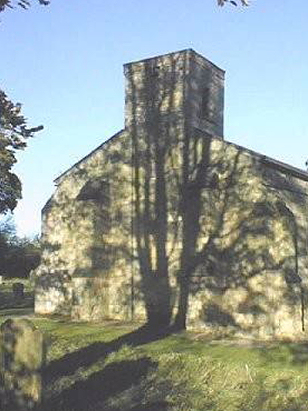
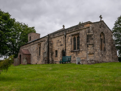
Millington St Margaret
| |
England
& Wales Hardwicke Marriage Index |
The ParishThe parish of Millington lies in southeastern Yorkshire, within the East Riding and roighly 3 miles northeast of the small town of Pocklington. Millington sits about 2 miles north of the B1246 road which links Pocklington towards Great Driffield arriving as the A614. Millington is a small and compact village built around a network of narrow lanes which forma slanting "8"-shape, it sits beneath the escarpment of the Yorkshire Wolds as a spring-line settlement, it is tucked away within a semi-circular basin within a fold of the escarpment. Millington is a farming parish, early gazetteers estimated a rough 2:1 spread in favour of arable over pastoral methods. The pastoral fields are largely upon the Wolds whilst arable hugged the valley. Today Millington receives a few visitors from the Yorkshire Wolds Way National Trail which follows the escarpment edges high above since it provides overnight accommodation at its welcoming inn. Millington is drained southwestwards by Millington Beck which becomes Pocklington Beck before crossing low-lying land where it has been canalised before joining the Derwent for the journey to the North Sea arriving through the Humber Estuary. Millington is sited at on rising ground from 100 to 110 metres above the sea, the escarpment looming to the east rises a further 100 metres in steep slopes peaking at just over 200 metres in places. Covering just under 2,400 acres Millington parish was towards the larger end of the rural farming parish scale, that acreage would have supported a population of close to 250 parishioners. Domesday's entry for Millington is ambiguous in representing an area rather than the single manor, it is possible to discern that Millington was "waste" having been impacted by the "Harrowing of the North" conducted by King William to suppress northern rebellions. |
 |
|
|
|
| Register No | Covering Dates | Deposited With | Register Style | Quality Standard | Comments |
| 1 |
19th May 1755 - 24th November 1812 |
Borthwick Institute - York - Reference - PR/MIL/5 |
Standard preprinted and self-numbered combined Banns &
Marriage register with 4 entries per page |
Grade 2 Register - not a perfect read but with a low
likelihood of misreads |
None |
| 2 | 7th March 1814 - 8th May 1837 | Borthwick Institute - York - Reference - PR/MIL/6 | Standard Rose style preprinted and prenumbered Marriage register | Grade 1 Register - Few issues noted and a low likelihood of
misreads |
None |
|
Kirby
Underdale All Saints
|
Huggate
St Mary
|
Huggate
St Mary
|
|
Bishop
Wilton St Edith
Pocklington All Saints |
 |
Huggate
St Mary
Warter St James |
|
Pocklington
All Saints
|
Kilnwick
Percy St Helen
|
Warter
St James
|
1760 1770 1780 1790 1800 1810 1820 1830
Corrections to Tinstaafl Transcripts