|
The parish of Burnham Deepdale lies in the northwest of Norfolk, indeed
it forms a part of Norfolk's northern North Sea coast. Burnham Deepdale
lies about 2 miles northwest of the small market town of Burnham Market
and sits on the A149 coastal road which connects Hunstanton with Wells
next the Sea. Burnham Deepdale sits on the edges of Norfolk's extensive
coastal saltmarshes, an area protected by the island of Scolt Head, incidentally
"owned" by Burnham Norton and thus preventing Burnham Deepdale
from having a more extensive portion of the coastline. Burnham Deepdale's
economy would have been a mixture of land-based arable farming with pastures
on the higher marshes together with marine-based fishing, wildfowling
and shell fishing. Today the area is very much a touristy one with wildlife
enthusiasts drawn by the birds and hikers following the Norfolk Coastal
Trail which passes through the village.
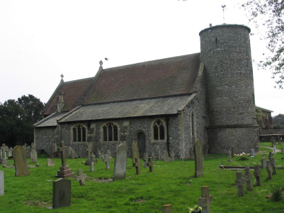
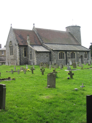
St Mary's church sits on the edge of the saltmarshes and to the north
of the A149 in the heart of the village. The presence of a round tower
is usually indicative of an early church and in this case Pevsner dates
it to the pre-Conquest period making it one of Norfolk's earliest surviving
churches. Also early, but late 12th century, is the northern doorway whereas
the northern arcade is 14th century. Most of the fenestration dates from
replacement during the 15th century and is in the Perpendicular style.
Similarly a typical Victorian restoration, in this case in the 1870s,
also changed much of the fabric. St Mary's piece de resistance and worth
a visit in its own right, however, is internal to the church; the Norman
font from the early 12th century showing the 12 labours of the months
is a celebrated piece and a rare survival from that ancient time. There
is a small parking area to the west of the church which sits behind a
knee-height flint & brick wall with a wooden gateway granting access
to a churchyard which has few obstacles for photography.
|
 |