
West Dereham St Andrew
| |
1813 to 1880 Baptism Project West Dereham St Andrew |
Baptisms 1813 to 1880
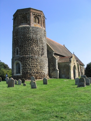
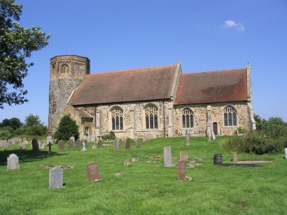
West Dereham is situated on the edge of the Fenland, where the land rises to the heights east of King's Lynn. The view is dominated by the vast expanse of lowland to the south-west of the village. West Dereham is a straggle of village mostly south of its church St Andrews which perches on the highest ground to the north. St Andrew's Saxon tower is an impressive edifice, more reminiscent of a Martello tower than a church, made predominantly of the local carrstone it predates the Norman conquest. The tower's wall stand thick against the bracing south-westerlies from the Fens. The area lies away from the major routeways of the A10 and A134 and was clearly devoted to agriculture in the Victorian period. Besides the plethora of labourers shown on the register the other trades illustrate that this was a rural area. |
 |
 |
|
| These records were transcribed from microfilm MF 1006 in the Norfolk Record Office collection, they are clear and generally very legible. |
Back 1820 1830 1840 1850 1860 1870 1880
Back 1820 1830 1840 1850 1860 1870 1880
Corrections to Tinstaafl Transcripts