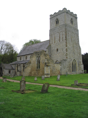
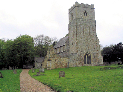
Flitcham St Mary
| |
1813 to 1880 Baptism Project Flitcham St Mary |
Baptisms 1813 to 1880
|
The parish of Flitcham lies in western Norfolk about 8
miles northeast of the port of King's Lynn and just north of the busy
A148 road which links King's Lynn with the market town of Fakenham. Flitcham
lies just over a half mile north on the B1153. The village has grown up
at the edge of the coastal plain, just where the higher ground of Norfolk's
chalk downlands begin to rise from the sandy soils of the carrstone beds.
To the east of Flitcham, on the higher ground, runs the ancient Peddar's
Way footpath. The parish is one of a number that have formed on this notable
break of slope and all are elongated in shape east/west to make maximum
use of both the lower and higher grounds. Whilst the sandy soils were
much used for mixed farming the higher ground was devoted to open skies,
warrens and sheep runs. |
 |
 |
|
| This parish has not deposited all of the baptismal records covering the period of the project. A single standard 800-entry register runs from 1813 to 1876, the remainder of the entries have been sourced from Bishop's Transcripts. The register is filmed on Microfilm MFRO396 in the collection of the Norfolk Record Office which was used to prepare this transcript. This film is a recent one and the images benefit from the improved techniques used in recent times, a straightforward read with clear images. The BTs are of a lesser quality but fortunately the 4 years are present and readable. Hopefully few errors will have crept into a straightforward piece to transcribe. |
Back 1820 1830 1840 1850 1860 1870 1880
Back 1820 1830 1840 1850 1860 1870 1880
Corrections to Tinstaafl Transcripts