
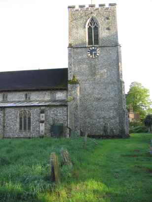
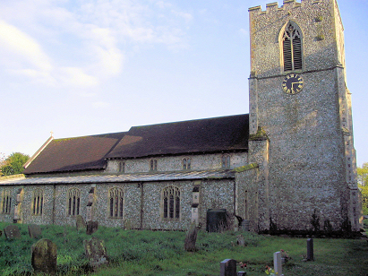
Rougham St Mary
|
|
1813 to 1880 Baptism Project Rougham St Mary |
Baptisms 1813 to 1880
|
The parish of Rougham lies in
west central Norfolk about 7 miles north of the market town of
Swaffham and a similar distance southwest of Fakenham. Rougham is
a small and compact village which lies a little over a mile west
of the A1065 road which connects the two above named places.
Rougham, like most Norfolk parishes, had a largely arable farming
economy with 90% of the parish acreage set to crops augmented by
small areas of pasture. The parish sits on the western edge of the
central Norfolk arable area, to its west land rises with
underlying chalk, an area formerly dominated by sheep walks as the
soil was less productive and which is crossed by the nearby
Peddar's Way ancient pathway. Rougham is, at its heart, an estate
village but one that has grown a small village despite the land
being concentrated into the holdings of a single family, Rougham
Hall, the home of the North family, dominates the village's
northwestern corner. The landscape around is fairly level with no
obvious high points dominating, a landscape of broad cereal fields
and big skies. |
 |
 |
|
| Sadly the register covering the period of this transcript has yet to be deposited with Norfolk Record Office so this transcript has had to be prepared from the extant Bishops' Transcripts which unfortunately are incomplete in their coverage. Several years are missing, 1861 (1 record), 1875 -1877 (5 records) and 1879 (5 records) and 3 records have incomplete dating data. Should the register finally come into the public domain these records will be added and the entire transcript rechecked to the official record. Like most BTs the quality throughout is highly variable from very good to poor and it is likely there will be a misread or two from the latter. |
Back 1820 1830 1840 1850 1860 1870 1880
Back 1820 1830
1840 1850 1860
1870 1880
Corrections to Tinstaafl
Transcripts