
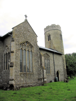
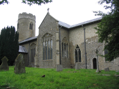
Stody St Mary
| |
1813 to 1880 Baptism Project Stody St Mary |
Baptisms 1813 to 1880
|
The parish of Stody lies in central northern Norfolk about
mid way between the market towns of Fakenham and Holt. Stody sits just
east of the B1110 road which links Holt to East Dereham. Stody is a small
parish in an area where churches are thick on the ground; there are probably
7 churches with two miles of Stody. Consequently the parish was relatively
lightly populated despite the good agricultural land in which it sits.
Stody is located in quite an undulating area for Norfolk with the rise
in ground up to the glacial ridges running just inland from the north
Norfolk coast. The village, which is little more than a hamlet, is sited
on the south bank of one of the tributaries of the River Glaven which
emerges into Blakeney Harbour just west of Cley next the Sea. |
 |
 |
|
| A single standard 800-entry register covers not only the period of the transcript but, indeed, continued until completed in the late 20th century. This register is filmed on Microfilm MF907 in the collection of the Norfolk Record Office which was used to prepare this transcript. Whilst the images for the film are of a good standard, the same cannot be said for the clerkmanship; the register has many entries where incomplete details are entered (missing dates, names and occupations etc.) and the handwriting leaves much to be desired in places. Readers will also note that spelling was not a strong point either and these have been left as entered. Thankfully images are online on Familysearch so manipulative tools are available to attempt deciphering of the worst entries. Despite all of these difficulties it is hoped that few errors will have crept in but they cannot be ruled out entirely. |
Back 1820 1830 1840 1850 1860 1870 1880
Back 1820 1830 1840 1850 1860 1870 1880
Corrections to Tinstaafl Transcripts