
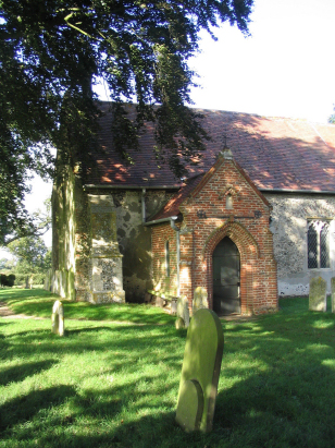
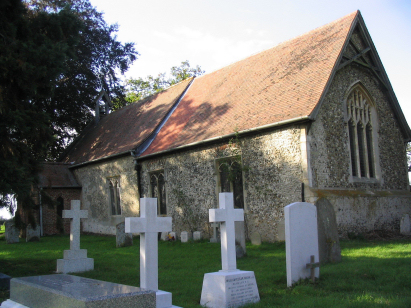
Thelveton St Andrew
| |
1813 to 1880 Baptism Project Thelveton St Andrew |
Baptisms 1813 to 1880
|
The parish of Thelveton lies in the extreme south of Norfolk
not too far from its border with neighbouring Suffolk. Thelveton is located
about 3 miles east of the market town of Diss and stands on the former
route of the A140, Norwich to Ipswich, road which thankfully for the villagers
now bypasses on a dual-carriageway. Thelveton is a rather small place,
a few properties grace the former junction with the A140 whilst the remainder
are scattered across the area of the parish as farms and cottages. The
parish acreage is dominated by the grounds of Thelveton Hall, an Elizabethan
E-plan hall the home of the Havers family at the time of this transcript.
The scattered settlement and lack of a true village is indicative of a
"closed parish" in which most land was held by the Havers which
discouraged inbound migration and kept the parish relatively depopulated.
The land is rich arable farmland with big fields and wide open skies as
it sits on a plateau just north of the influence of the Waveney valley
which forms the county border. |
 |
 |
|
| A single standard 800-entry register boom covers not only the period of this transcript but runs onward to completion only in 2008. This register is filmed on Microfilm MF744 in the collection of Norfolk Record Office which was used to prepare this transcript. Whilst not one of the much improved recent films it was adequate to the task and as a result this was a straightforward piece to prepare with only the usual grumbles regarding clerical neatness. |
Back 1820 1830 1840 1850 1860 1870 1880
Back 1820 1830 1840 1850 1860 1870 1880
Corrections to Tinstaafl Transcripts