England
& Wales Hardwicke Marriage Index
Marriages
1754 - 1837
Llandygai St Tegai
 |
England
& Wales Hardwicke Marriage Index |
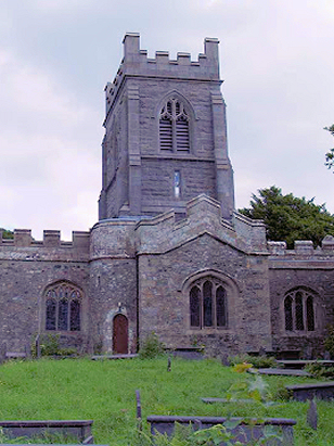
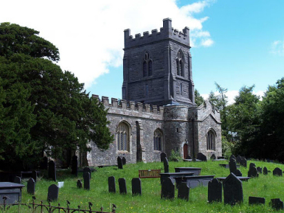
The ParishThe parish of Llandygai, sometimes spelt Llandegai, lies in northern Caernarvonshire forming a short stretch of the county's coastline with the Irish Sea. Llandygai is situated just over a mile east of the city of Bangor and sits on the A5 road which continues onwards to London. Whilst the village of Llandygai is a small and compact settlement on the edge of the estate of Penrhyn Castle, the parish is extensive running inland to encompass much of Snowdonia and stretching almost halfway across the county. The village of Llandygai was built as the estate village for Penrhyn Castle, most folk within the parish lived in its extensive hinterland. Llandygai does, however, have a long history reputedly extending back to the ancient Kings of Wales from c720 through to 1230. The parish was also the site of the last ever battle fought in Wales between Royalist and Parliamentarian forces in the Civil War. Penrhyn Castle, which dominates the northern part of the parish was built as a fantasy castle in late Georgian times. The economy of this parish was diverse with minerals and pastoral farming dominating, the list of minerals extracted from the hills of the Snowdonian portion is extensive and dominated by copper, iron & lead. The farming is largely arable towards the coast but the inland portion is dominated by high uplands (the mountains of Snowdonia being the highest in Wales) and rough grazing. During the period of this transcript the extraction of slate grew from a small cottage-industry into a major employer growing to a tonnage of 120,000 per annum by 1841. Today the economy is largely underpinned by tourism, the high mountains and splendid scenery attracting visitors from around the world. Many rivers drain into the main feeder route of the Afon Ogwen which drains through Llandygai to the Irish Sea a couple of miles north of the village. Llandygai village is sited at around 40 metres above the sea but the parish is extensively upland reaching heights in excess of 1,000 metres in the mountains of its interior. As stated Llandygai parish was extensive, it covered almost 15,500 acres and would have supported a population of close to 3,000 parishioners. Like most of Wales Llandygai is noted mentioned in Domesday Book which did not cover this area. |
 |
|
|

|
| Register No | Covering Dates | Deposited With | Register Style | Quality Standard | Comments |
| 1 | 20th May 1754 - 26th December 1812 | Gwynedd Archives - Caernarvon - Un-catalogued register | Standard preprinted and self-numbered combined Banns & Marriage register with 4 entries per page | Grade 2 Register - not a perfect read but with a low likelihood of misreads | None |
| 2 | 8th January 1813 - 24th June 1837 | Gwynedd Archives - Caernarvon - Un-catalogued register | Standard Rose style preprinted and prenumbered Marriage register | Grade 2 Register - not a perfect read but with a low likelihood of misreads | None |
|
|
||
|
Bangor
St Deiniol
Llandeiniolen St Deiniol |
 |
|
|
Llanrhychwyn St Rhychwyn
Llanrwst St Grwst, Denbighshire (detached) |
1760 1770 1780 1790 1800 1810 1820 1830
Corrections to Tinstaafl Transcripts