England
& Wales Hardwicke Marriage Index
Marriages
1754 - 1837
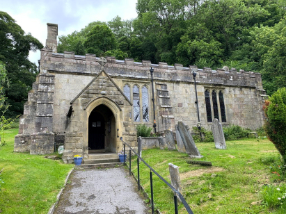
Carsington St Margaret
 |
England
& Wales Hardwicke Marriage Index |
The ParishThe parish of Carsington lies in western Derbyshire roughly 6 miles northeast of the market town of Ashbourne. Carsington sits immediately north of the B5035 road which links Ashbourne through to Matlock. The village is tucked away and accessed along an out-and-back lane from the B5035 most properties sitting flush beneath the prominent limestone face of the hills to its north. The area is dominated by limestone, quarried for many centuries the local hills are dotted with remnants of man's removal of this fine building stone, in addition quarries were dug to extract lead ore; farming in the area is strictly limited to rough grazing of sheep, the limestone producing close cropped turf as a side-line. Modern developments have come to the area, the Peak Forest Railway, however, has been closed and is now followed by local hiking and cycling trails as the Midshires Way & Pennine Bridleway, a more permanent mark on the landscape is the flooding of the valley below the village to form Carsington Reservoir supplying the northern towns of the Midlands and Potteries with their fresh water. Today, whilst limestone quarries still form an important element of the local economy, it is tourism attracted by the delights of the White Peak, as the area is known, who underpin many enterprises. Once free of the reservoir the Henmore Beck drains the parish southwestwards merging with the River Dove west of Ashbourne, the Dove performs a large western meander before meeting the Trent during its lengthy route to the North Sea arriving through the Humber Estuary. Most of Carsington is sited at around 220 metres above the sea with its western edge 20 metres higher and the reservoir similarly 20 metres below, 100 metres slopes rise steeply to the north of the village rising more gently to local high points, notably 379 metres on Harboro' Rocks. Parishes in the Peak District are often extensive, Carsington was not one of those covering only a little over 1,100 acres which supported a population of close to 250 parishioners. Carsington is an anomaly in Domesday Book recording just 9 households yet having 18 ploughs, together with meadows & woodland these assets were held directly by King William. |
 |
|
|

|
| Register No | Covering Dates | Deposited With | Register Style | Quality Standard | Comments |
| 1 | 29th October 1754 - 16th February 1790 | Derbyshire Record Office - Reference - D2681/A/PI/3/1 |
Nonstandard preprinted and self-numbered combined Banns & Marriage register, it is nonstandard in being half-size with only 2 entries per page | Grade 2 Register - not a perfect read but with a low likelihood of misreads | None |
| 2 | 27th October 1790 - 4th November 1811 | Derbyshire Record Office - Reference - D2681/A/PI/3/2 |
Standard preprinted and self-numbered Marriage register with 4 entries per page | Grade 2 Register - not a perfect read but with a low likelihood of misreads | None |
| 3 | 6th May 1813- 18th January 1837 | Derbyshire Record Office - Reference - D2681/A/PI/3/3 |
Standard Rose style preprinted and prenumbered Marriage register | Grade 2 Register - not a perfect read but with a low likelihood of misreads | None |
|
Wirksworth
St Mary
|
||
 |
Wirksworth
St Mary
|
|
|
Hognaston
St Bartholomew
|
Wirksworth
St Mary
|
1760 1770 1780 1790 1800 1810 1820 1830
Corrections to Tinstaafl Transcripts