
England
& Wales Hardwicke Marriage Index
Marriages
1754 - 1837
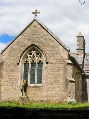
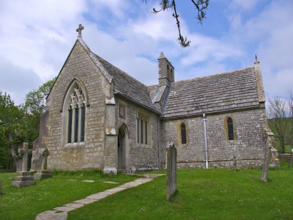
Tyneham St Mary
| |
England
& Wales Hardwicke Marriage Index |
The ParishThe parish of Tyneham lies in southeastern Dorset forming an extensive stretch of the county's English Channel coastline. Tyneham is located roughly 6 miles southwest of the market town of Wareham and sits about 3 miles south of the B3070 road that connects Wareham with Lulworth Cove. Tyneham is often referred to as Dorset's "lost village", it and the surrounding countryside were requisitioned by the Army in December 1943 to act as a training ground for D-Day preparations, the land has not been relinquished since and is still used a live firing range. All of the villagers were removed and access restrictions imposed, today, however, a slightly more user-friendly image is taken as access is permitted to a small museum and church most weekends and when firing is not taking place, access which also sees a steady stream of hikers along the South West Coastal Trail which passes through both parish and ranges. At the time of this transcript Tyneham would have earned its income from pastoral farming, sheep grazing the Downs to north and south. Tyneham is drained the short distance southwest by a small stream reaching nearby Worbarrow Bay. Tyneham is sited at around 50 metres above the sea but sits between two ranges of Purbeck hills, chalk to the south reaching 167 metres above Gad Cliff whilst to the north limestone reaches 185 metres on Whiteway Hill. Tyneham parish was large for a southern English parish, most on Purbeck are too, covering a little over 2,800 acres it would have supported a population of around 250 parishioners. In Domesday times Tyneham was shared by no fewer than 4 landholders, the majority in the hands of one Ansketil of Cherbourg, the assets amounted to just 3 ploughs and the usual meadows, pastures & woodland. |
 |
|
|
|
| Register No | Covering Dates | Deposited With | Register Style | Quality Standard | Comments |
| 1 |
2nd September 1754 - 29th July 1811 |
Dorset History Centre - Reference - PE-TYN/RE/3/1 |
Standard preprinted and self-numbered combined Banns &
Marriage register with 4 entries per page |
Grade 3 Register - there are sufficient quality issues
with this register to indicate that some misreads will occur
albeit few in number |
Poor handwriting through this register may result in some
misreads |
| 2 | 21st June 1813 - 2nd May 1836 | Dorset History Centre - Reference - PE-TYN/RE/3/2 | Standard Rose style preprinted and prenumbered Marriage register | Grade 2 Register - not a perfect read but with a low likelihood of misreads | None |
|
Coombe
Keynes Holy Rood
|
East
Stoke St Mary
|
East
Stoke St Mary
|
|
East
Lulworth St Andrew
|
 |
|
|
|
|
|
1760 1770 1780 1790 1800 1810 1820 1830
Corrections to Tinstaafl Transcripts